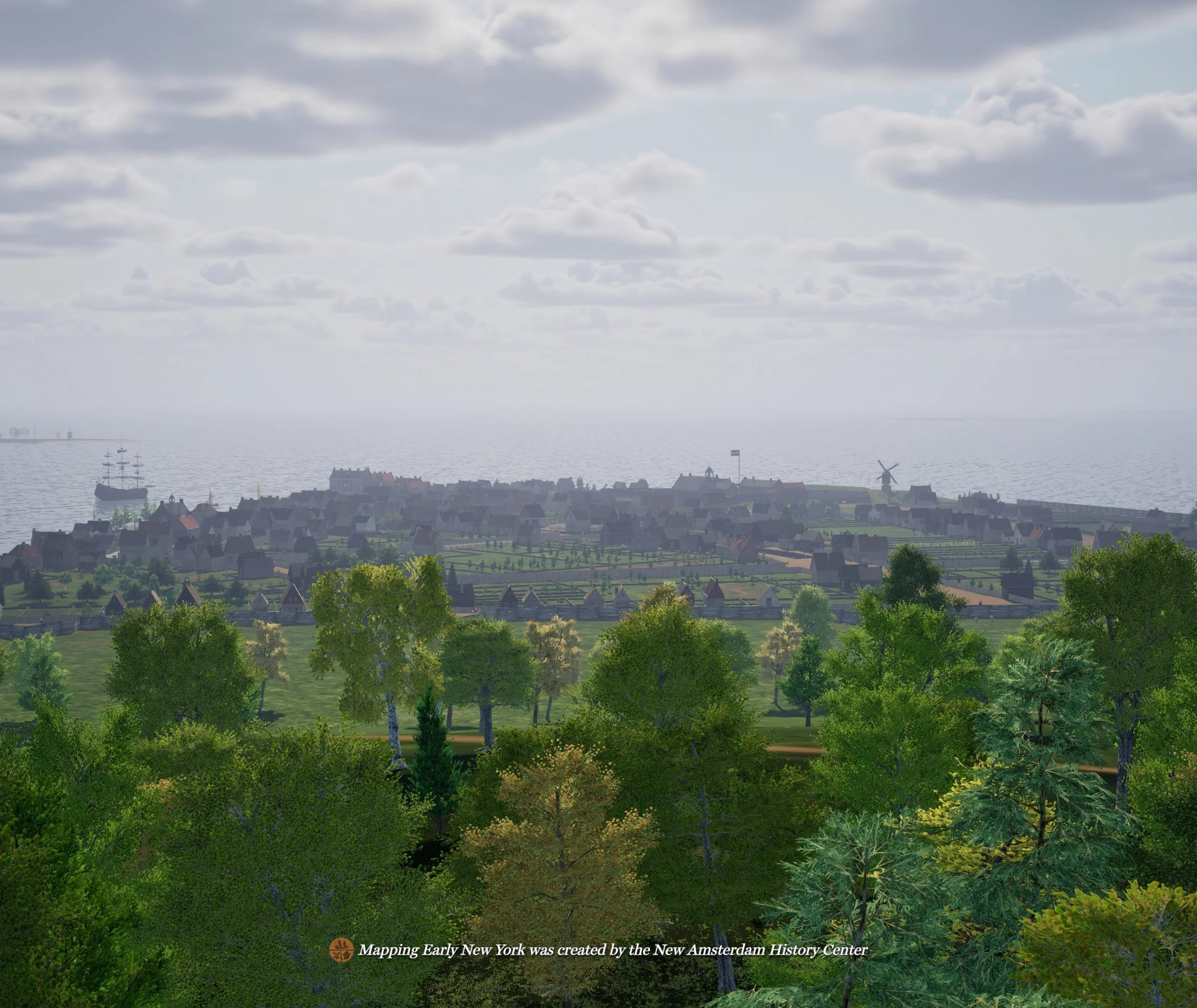
New Amsterdam seen from the “Land of the Blacks” an area of farms owned by former enslaved people that is now Greenwich Village. Still, Mapping Early New York, Courtesy of the New Amsterdam History Center.
“New Amsterdam’s enslaved blacks were essentially the colony’s first municipal labor force. Those who were owned by the DWIC, as well as privately owned slaves, cleared forests and fields, constructed roads, and helped build fortifications like Fort Amsterdam and the Wall (later Wall Street) which spanned the island from the Hudson River to the East River. Typically, women worked as cooks, farm workers, mill laborers and performed household chores.”
—Chris Moore, New York Public Library
Outlines of land granted to formerly enslaved people north of the wall in the area known as the “Land of the Blacks.” The practice of granting land went on for many years, and research is ongoing. The Iconography of Manhattan Island, 1498-1909: Volume 6. Stokes, I.N. Phelps. Pages 84B-a. Courtesy of the Municipal Library, City of New York.
On February 25th, 1644, the Dutch West India Company resolved a petition of ten enslaved men who were demanding their freedom. The Company granted conditional freedom for the men and their wives, but not for their children who remained enslaved. The Company granted them farmland north of the town that had been abandoned by white settlers during Kieft’s war. They, along with some men given freedom earlier, were expected to farm the land and give up a portion of the produce annually to the colony in order to maintain their freedom. The area became known as the “Land of the Blacks,” and eventually remnants of it were called Little Africa.
On February 25, 1644 the Council granted Paulo Angolo, Big Manuel, Little Manuel, Manuel de Gerrit de Reus, Simon Congo, Antony Portuguese, Gracia, Piter Santomee, Jan Francisco, Little Antony and Jan Fort Orange along with their wives, a ‘release from servitude’ and land in an area north of the town. They had served the Dutch West India Company for 18 or 19 years. Series A1809, Dutch Colonial Minutes, Feb 1 – 3 March 1644, Document IDNYSA_A1809-78_V04_p183-184. Courtesy of the New York State Archives.
In 1667, the first English Governor, Richard Nicolls, wrote confirmations of the original Dutch ‘letters patents’ to many of the formerly enslaved people. This ensured that the land remained in their possession as the settlement transitioned from Dutch to English rule. Here is recognition of Manuel de Gerrit de Reus, Cristofel Santome, and Groot Manuel. New York (State). Department of State. Bureau of Miscellaneous Records. Letters patent. 12943-78. Volume 2, page 122. Document ID NYSA_12943-78_V02_p122. Courtesy of the New York State Archives.
A partial listing of the formerly enslaved people granted land north of the main settlement in the area known as the “Land of the Blacks”:
Manuel de Gerrit de Reus — Catalina Anthony & Jochim Anthony — Domingo Antony Jan Negro — Bastien Negro — Gracia (Gratia) d’Angola — Antony Congo — Manuel de Groot — Anthony Portugis — Paulo d’Angola — Cleyn “Little” Anthony — Cleyn Manuel — Pieter Santome — John (Jan) Francisco — Simon Congo — Cristofel Santome — Maria d’Angola — Francisco Negro — Domingo Angola — Maykie (Maryke) widow of Lawrence and later wife of Domingo Angola — Jan Fort Orange — Manuel Trumpeter — Ana “Negriana’ d’Angola widow of Andries d’Angola
Despite the assurances of Governor Nicolls, by the late 1600s, the land had been stripped away from these families by a series of English laws restricting or prohibiting land inheritance or ownership by blacks. They were rendered tenant farmers on their own land. The Municipal Archives has an expansive map collection which includes conveyance records of property, but more research and conservation work on these early records is required. Slave births and manumission records date to the mid-18th century. Bills of sale and some court records documenting enslaved people can be found in Common Council Collections, Old Town Records and Estate Inventories.
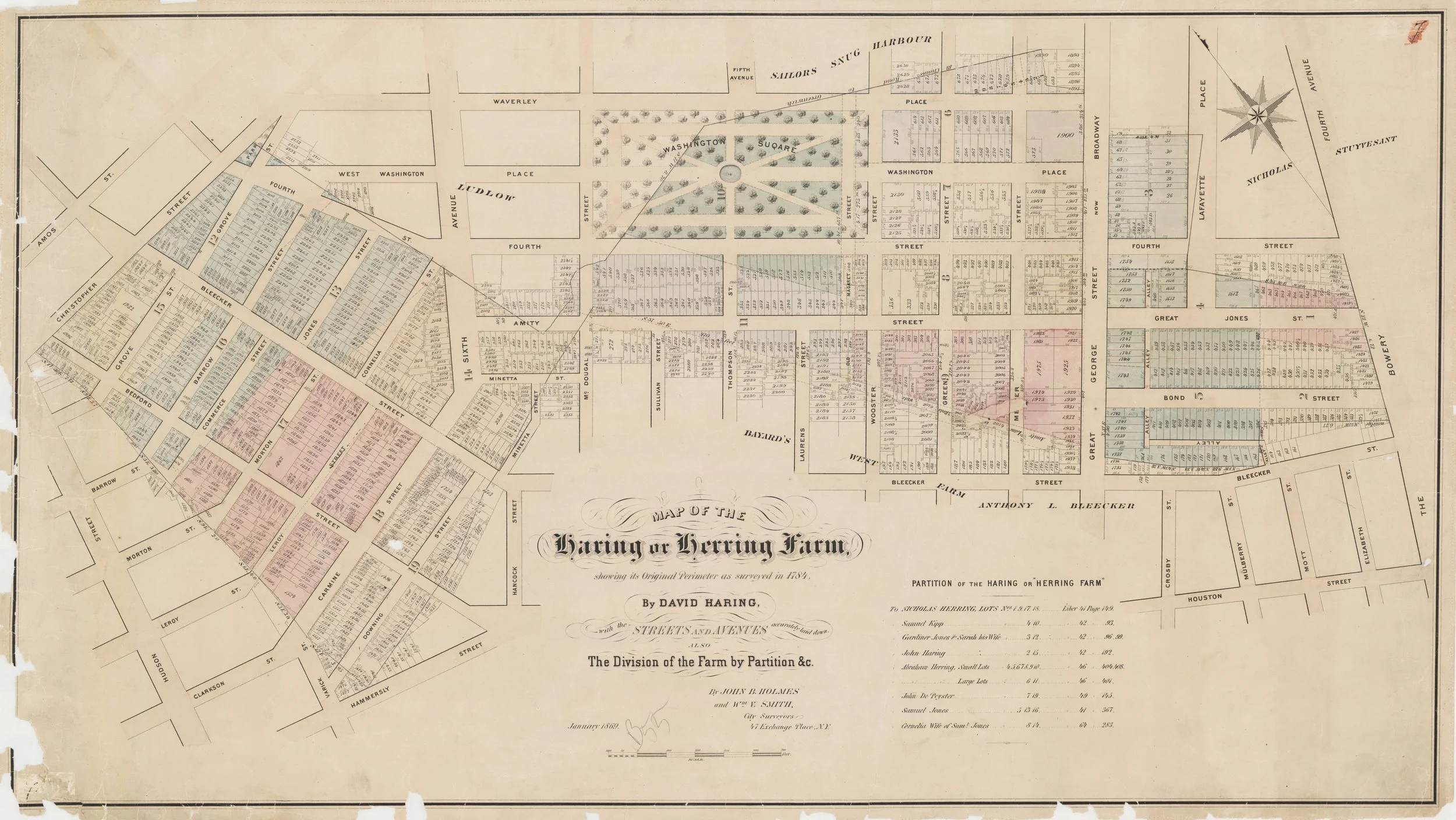
Map of the Herring Farm, 1869. Manhattan Farm Maps, #15, ACCN: 1983-039. Courtesy of the Municipal Archives, City of New York. The Herring Farm encompassed many of the original black land grants in the area south and east of Washington Square Park.
LinkNYC video display. Eduard van Dijk, designer.