The Municipal Library is a Library—A Conversation with Julie Robbins

On June 24, 2026, sometime late afternoon, encircling the wooden conference table of the Department of Records and Information Services headquarters at 31 Chambers, where on the walls, assembled as asymmetrical triptychs are framed historical black-and-white photographs of bridges, street scenes, or graphic news clippings, three DORIS staff sat. At the center of the table two cell phones recorded a conversation: Commissioner Smith-Cruz with Assistant Commissioner Cobb, sat across from the Deputy Librarian, Julie Robbins. At the eve of her retirement, what began as an interview quickly became a recalling of the role and its impact on our city’s records. Below is a snippet of the conversation.  

Photos of Julie Robbins by Matt Minor

Shawn(ta) Smith-Cruz: Julie, Ken may already know this, but I’m new. Tell us what brought you into the Municipal Library.

Julie Robbins: I worked as a lawyer for many years until I finally smartened up and realized that it wasn’t what I wanted to be doing. I was already quite mature and decided to go to library school. I think I may have been by far the oldest in my class, but it was great. Then I noticed an internship posting for the Municipal Library. I applied, and I never left. 

Ken Cobb: The Municipal Library is a library, obviously, and it is open to the public. But it is not a public library. Tell us how that informs the operation of the library and or the services.  

JR: The last commissioner, Pauline Toole, had a very strong commitment to having the Municipal Library be fully open to the public. That does inform how we handle the reading room, for instance, because walk-ins are still allowed and encouraged to come in. There were times when that made us more like a branch of the New York Public Library. Our rules and regulations for use are informed by what a regular public library has to put in place for safety, and so on.  

SSC: Tell us about the GPP. What is it? What is it good for? And what have you done for it?  

JR: The Government Publications Portal! I’d say I’m “cheerleader in chief,” probably. Joel Castillo was the head of applications development. He started here when he was in college and went on to head the applications development team. Early on in his tenure, he wrote the code to create a digital library. And so, the government publications portal is a digital library. And we are actually tasked by the charter to maintain a digital library of the City’s publications. It used to be that the charter required every agency to send us four copies of every single thing they published. But the agencies gradually phased out paper publications, and we started not having room for all the hard copy.  

SSC: What’s the status of the GPP now? How can it grow? 

JR: Oh, it can get a lot better. Our search is a little wonky. It’s a little too thorough, but better too thorough than not, I suppose. Our user experience, both for the agency submitters, and for the public, is in need of a tune up. We haven’t linked WorldCat to the digital items. Our regular catalog Koha, which is powered by Bywater, is available in WorldCat. At some point, syncing the GPP would make both discoverable. I don’t have the technical chops to do that myself, but somebody probably does. 

SSC: I'm curious about reference work. Explain to me the reference ecosystem.  

JR: Differently than archives, as it relates to the library, it’s actually fairly straightforward. You show a researcher the library catalog. We either have it or we don’t. We pull it for them. One thing we do find often is that researchers access our collections through the Archives. They know the Municipal Archives. It is better known than the Library. So sometimes we have to, like, chivvy our Archives’ colleagues into making sure that researchers know that there are published materials from the agency that they want, and it’s not just the archival material.  

KC: The Municipal Library is more than just the GPP. Maybe you could tell us about some of your favorite library publications or items you think our readers would be surprised to know are in the library.  

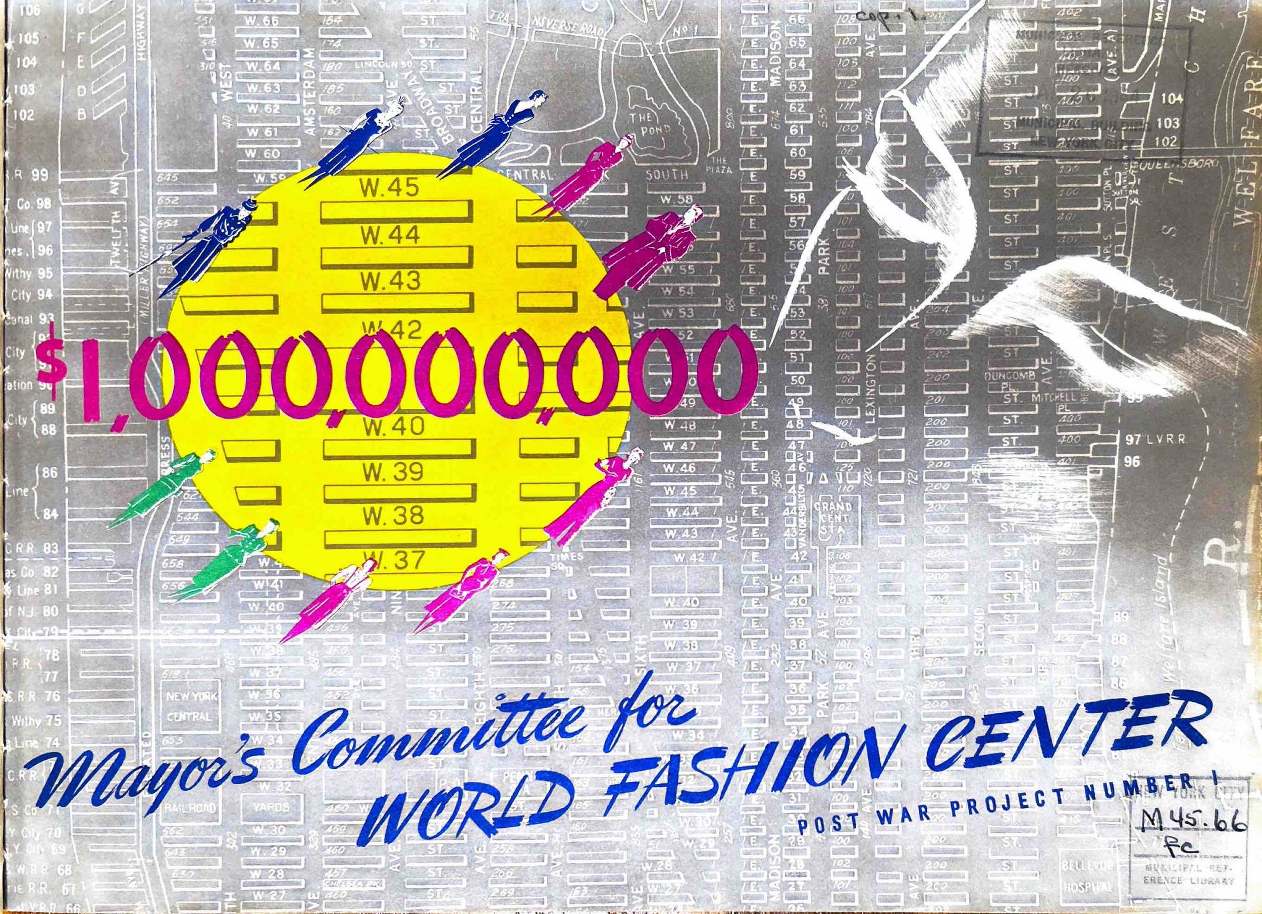
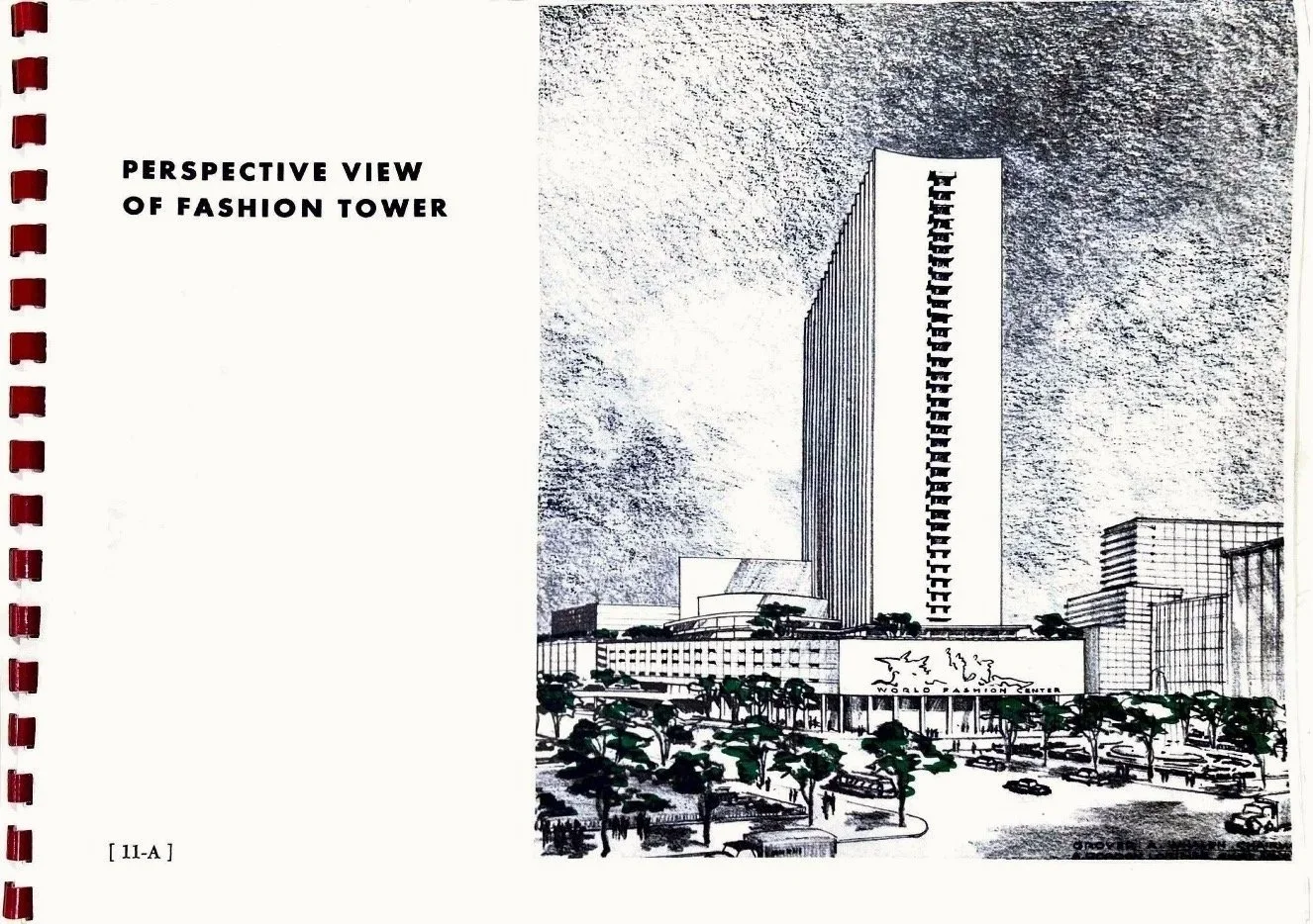
JR: I would say one interesting thing is that almost every mayor had a sort of a “pet topic” or nurtured a particularly fun thing. For example, [Mayor William] O’Dwyer, liked the fashion industry. And LaGuardia has this whole section about civil defense activity because he served during wartime and the Feds appointed him to do emergency work.  

KC: And then there are the vertical files! 

JR: The vertical files are so cool!  

SSC: I know about this collection.  

JR: Yeah, yeah! The librarians gathered campaign brochures and informational materials. The political ones I find particularly amazing, all the way from 1927 to the ’80s. Here’s an example you can research: what role did the German Bunds play in the 1920s political situation in New York? 

KC: The neighborhood files are good, too. 

JR: And the neighborhood files are really good, too. Yeah. 

KC: And the biographical, they have a whole section. 

JR: You know, hardly anybody ever looks at those. It’s so interesting. We have clippings about almost every prominent New York City agency employee or politician. It usually includes at least the obituary, and if some police captain gets promoted to a district captain, there’s that. They’re all in binders. They got glued onto pieces of paper, a preservation nightmare, of course; the glue is giving out on a lot of it. 

SSC: Are there any biographies or stories of people that have stood out to you during your time as Deputy Librarian? 

JR: I have a standing coffee date with a previous researcher here, Gil Tauber, who is part of a group called the Bloomingdale Neighborhood History Group. He’s 91. And when he started coming here when he was 87, he was creating a database of street names in New York and building a website, Old Streets, New York. He physically tracked through the entire Board of Aldermen series and wrote down the origin for all street names. We saw a fair amount of him, and I realized that he lived in the neighborhood, so I would run into him on the street, and eventually, Gil and I started having coffee together pretty much every week now.  

SSC: That’s wonderful that you generated this personal relationship! 

JR: The personal relationships in any job are a big part of it. Getting to know the people who are so knowledgeable about, and so committed to City government, and making City government accessible. People like Ken Cobb, and Pauline Toole, and Lauren Gilbert, and, you know, many of my colleagues, has really been wonderful.... I really like being able to help people figure out how to access different city materials. That’s one of the things I’m going to miss.   

KC: Well, is there anything else that you would want to share with the world?  

JR: No.  

SSC: You’ve done it all.  

KC: You said it all.

JR: I’ve said enough. Yeah. Yeah.  

SSC: What’s next for you?  

JR: I’m gonna be traveling! Both on my own, you know, for pleasure and also to visit my, my daughter and granddaughter. Grandma stuff. That’s pretty much the agenda. I’m gonna become bicoastal.  

KC: Nice. And I’ll see you at the farmer’s market.  

JR: And you’ll see me at the farmer’s market. I go in the early morning.  

Welcome to Fear City 

In my search for content that I could use to write curriculum aids, I came across a startling item in the Municipal Library vertical files: Welcome to Fear City: A Survival Guide for Visitors to the City of New York 

The cover image was too compelling to ignore, and its contents were even grimmer than expected. This “Survival Guide” contains nine “tips” for, well, surviving a vacation in the Big Apple. As you can see when you click inside the pamphlet, the tips are ominous, foreboding warnings such as “do not walk,” “avoid public transportation,” “Remain in Manhattan,” and “stay off the streets after 6 P.M.”

I was baffled as to who would create this brand of menacing travel brochure, but the reasons for its existence are clearly stated in the pamphlet: “By the time you read this, the number of public safety personnel available to protect residents and visitors may already have been still further reduced. Under those circumstances, the best advice we can give you is this: Until things change, stay away from New York City if you possibly can.” 

Here’s some back story.

The fiscal crisis in 1975 led New York City to enact extreme budget cuts; city workers experienced reductions in salaries and pensions, and more than 50,000 people (one-sixth of the workforce) were laid off. On July 1, 1975, 5,000 police officers, many in radio-car patrols, were furloughed, along with 1,600 firefighters—20% of the city’s entire department, 7,000 teachers, and many highway, sanitation and bridge workers. Initially, some unions reacted strongly. Highway workers picketed during rush hours, teachers went on strike for one week at the beginning of the school year, and sanitation workers left 48,000 tons of garbage on the street for two days. There are also accounts of bridge workers walking off the job with three drawbridges still raised.

REC0022_01_1975_010_10: Unsafe building, Georgia Avenue and Liberty Avenue, Brooklyn, January 30, 1975. Photograph by Paul Rice, Department of Housing Preservation and Development photograph collection, NYC Municipal Archives.

New York City police officers took a different approach. The Council for Public Safety (a consortium of municipal labor unions but mostly NYPD and FDNY) created and distributed the Fear City “survival guide” pamphlet to deter tourists from visiting the city, citing high crime rates and an increasingly dangerous environment. They printed one million copies and distributed them over a few days at JFK airport. Authorship of the pamphlet is attributed to “uniform” unions, but Ken McFeeley, president of the Patrolmen’s Benevolent Association in New York City, was the man behind the campaign.

REC0022_01_1975_070: Removal of cars from site, Department of Relocation, 36 Pitt Street, Manhattan, May 14, 1975. Photograph by Leonard Boykin, Department of Housing Preservation and Development photograph collection, NYC Municipal Archives.

This pamphlet was not designed as public policy guidance from City Hall. It was dystopian propaganda and one of the boldest public pressure campaigns in the City’s history.

This stated, the facts remain. Across the city, crime and violent crime was on the rise and had been for years. The number of murders, car thefts and assaults had doubled (or more) from 1965 to 1975. The rate of burglaries and rapes had more than tripled. (The Guardian, 2015)

Despite the increase in crime, 10.5 million tourists still visited each year. Many New Yorkers couldn’t fathom why the unions who were hired to protect the city (and paid with tax dollars) would try to reduce any streams of income during the fiscal emergency that led to their members layoffs.

The Municipal Archives WNYC moving image collection also includes a video of elected officials discussing the campaign.

REC0047_1_3339: Feedback On Pamphlet, “Welcome To Fear City”; Council President Paul O’Dwyer, Council Member Reverend Gigan, June 13, 1975. WNYC-TV collection, NYC Municipal Archives.

REC0022_01_1975_046: Collapsed landmark building, 318 Hicks Street, Brooklyn, April 4, 1975. Photograph by Leonard Boykin, Department of Housing Preservation and Development photograph collection, NYC Municipal Archives.

As you’ll see in the video, there was a sentiment that this campaign only added insult to injury to a city already in crisis. Council President Paul O’Dwyer called the campaign “the worst piece of propaganda” and “a certain kind of madness.” He even said it should be considered “criminal libel” due to its “false and deliberate” nature. He sponsored a residency bill to make sure people who work for the city also live here. The video contends that the general population, including members of the unions in the Council for Public Safety, did not support the Fear City campaign. In fact, the Police Department’s Captains Endowment Association, Lieutenants Benevolent Association, the Sergeants Benevolent Association, and the Uniformed Fire Officers Association publicly stated they did not support it. And, ultimately, the city’s unions wound up essentially risking their retirements by investing $2.5 billion in pension funds in the city’s bonds, which helped the city regain solvency. 

REC0022_01_1975_180: Collapsed building, 21 President Street, Brooklyn, December 4, 1975. Photograph by Leonard Boykin, Department of Housing Preservation and Development photograph collection, NYC Municipal Archives.

The pamphlets were distributed for two days but the effects of using fear as political leverage and spreading information with harmful intent are long-lasting. This artifact is a reminder of how perception can shape public policy and that propaganda doesn’t only come from the government.  There are many implications for today’s media consumers; this resource is definitely worth a closer look.

The Welcome to Fear City: A Survival Guide for Visitors to the City of New York is housed in the Municipal Library Vertical Files under the subject “Safety.”


Swanky Restaurants, Luxury Hotels, & Radical Theater: A Review of the Immigrant Communities of New York

Beginning in 2018, For the Record posted articles about the Municipal Archives ongoing project to preserve and inventory the Manhattan Building Plan collection. In the most recent post last year, Project Archivist Amy Stecher provided a Building Plan Update. This week, conservator Elsie Karlak contributes a narrative of her three months on the project:

Everybody gets confused sometimes. REC0074_0418_043: Front elevation, 293 Broome Street. Manhattan Building Plans Collection, NYC Municipal Archives.
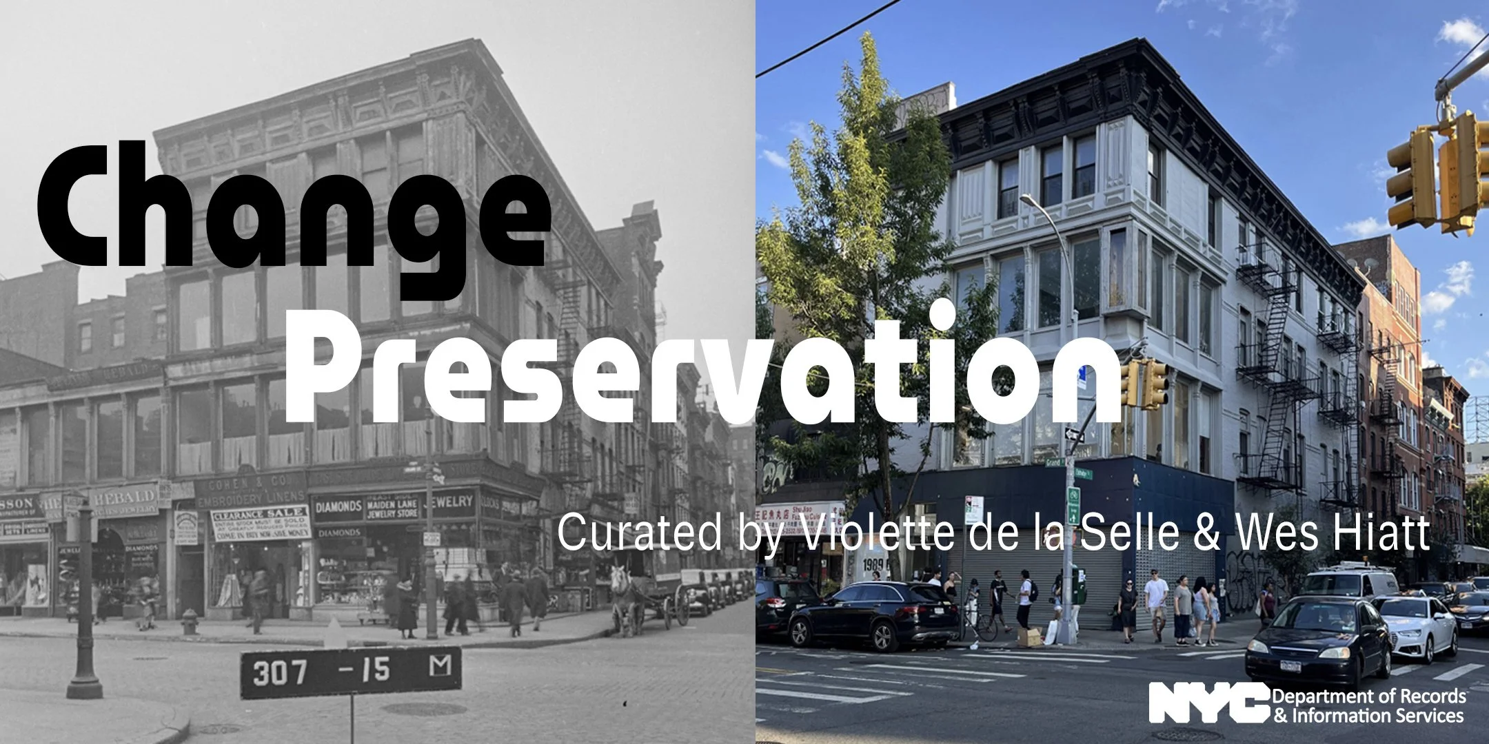
I was lucky enough to join colleagues as we continued to process plans for buildings located in the Lower East Side of Manhattan. The first home for many immigrants to the United States, this neighborhood experienced rapid growth during the late 19th and early 20th centuries as evidenced by the large volume of “new building” (NB) applications submitted to the Department of Buildings to construct multi-family dwellings, usually described as tenements. Likewise, requests for permits to add plumbing, fire escapes, and other alterations illustrated the ongoing work necessary to make tenements safer for their residents.

I also discovered plans for many other aspects of city life such as entertainment venues, community service organizations, schools, and places of worship. The plans chart the ebb and flow of the neighborhood, as immigrant communities moved out and others moved in, and as city officials created parks and public housing.

Here are some highlights of what I discovered along the way. 


Entertainment:

Block 416, Lot 20

This plan shows a swanky restaurant called Jack Silverman’s Old Romanian with space for 500 diners, dancing, and an orchestra. The Crystal Lounge wound around the curved bar.

REC0074_0416_020: Jack Silverman’s Old Romanian, 169-171-173 Allen Street. First floor plan. Manhattan Building Plans Collection, NYC Municipal Archives.
169-171-173 Allen Street, ca. 1939. 1940s Tax Photograph collection, NYC Municipal Archives.
Block 416, Lot 8

A short-lived radical theater, the plan depicts a classic black box theater, with seating around a central stage. The “People’s Drama” appears to be most famous for a run of a play, Nat Turner a highly fictionalized dramatization of the uprising led by the enslaved Nat Turner in 1831.

REC0074_0416_008: The People’s Drama, 210 Eldridge Street. Manhattan Building Plans Collection, NYC Municipal Archives.
210 Eldridge Street, ca. 1939. 1940s Tax Photograph collection, NYC Municipal Archives.
 Block 427, Lot 27

This theater was one of many ventures by the Minsky brothers, famous for staging burlesque shows. Designed by theatre architect Thomas Lamb, it became the home for Yiddish productions and burlesque shows. The NB plans show the orchestra seating area and the curtain line that would hide backstage.

REC0074_0427_027_01: Minsky Theatre, Houston and Chrystie Streets. Manhattan Building Plans Collection, NYC Municipal Archives.
111-117 East Houston Street, ca. 1939. 1940s Tax Photograph collection, NYC Municipal Archives.
Block 420, Lot 39

A luxury hotel in the heart of the Lower East Side? I was confused when I came across plans for a twelve-story building, seemingly out of place amongst the walk-up tenements I had been cataloging. The Libby Hotel and Baths, built in 1924 for a staggering $1.3 million, was the passion project of Max Bernstein. Unfortunately, the venture was short-lived. The property was foreclosed and the hotel was demolished in 1934. The City took the property via eminent domain, along with seven blocks along Houston and Canal Streets to build the Sara D. Roosevelt Park.

REC0074_0420_039_01: The Libby Hotel and Baths, 12 Story Hotel and Baths to be erected at the NE corner of Delancey and Chrystie Street, Chrystie Street Elevation. Manhattan Building Plans Collection, NYC Municipal Archives.
REC0074_0420_039_02: Plan of Sub-Cellar, The Libby Hotel and Baths. This plan show the maze of electricity that powered the Russian and Turkish baths. Manhattan Building Plans Collection, NYC Municipal Archives.

Community Spaces:

Blocks 418 Lot 1

Sara D. Roosevelt Park is named after President Franklin D. Roosevelt’s mother, the first Presidential mother to be alive for her son’s inauguration since George Washington took office in 1789. One of the first projects completed by Robert Moses after his appointment as Parks Commissioner by Mayor Fiorello LaGuardia in 1934, the plans include wading pools, playgrounds, “comfort stations” (bathrooms), and landscaping. My favorite plans show a diagrammatic view of the park benches, and the textures used for different stones in the paving and landscaping.

REC0074_0418_001_01: Chrystie - Forsythe Park Plots [Sara D. Roosevelt Park], Detail of Foot Bath, Plot Plan of Building C, Park Benches, Curb Enclosures for Vines. Manhattan Building Plans Collection, NYC Municipal Archives.
REC0074_0418_001_02: Chrystie - Forsythe Park Plots [Sara D. Roosevelt Park], Canal to Houston Street, construction plan of plot between Grand and Broome Streets, Block 5, building C. Manhattan Building Plans Collection, NYC Municipal Archives.
REC0074_0418_001_03: Chrystie Forsythe Park Plots [Sara D. Roosevelt Park], Construction details of Foot Bath, Ramp Steps & Scum Gutter of Wading Pools. Manhattan Building Plans Collection, NYC Municipal Archives.
Block 415, Lot 18

The University Settlement House was the first settlement house in the U.S. Created by reformers during the Progressive Era of the early 1900s, settlement houses served poor immigrant communities. The plans show the organization’s library, lecture hall, and nursery.

REC0074_0415_018_01: University Settlement House, Plan of 2nd Floor. Manhattan Building Plans Collection, NYC Municipal Archives.
REC0074_0415_018_02: University Settlement House, 3rd Floor Plan. Manhattan Building Plans Collection, NYC Municipal Archives.
Block 415, Lot 20

Designed by McKim, Mead and White, the Rivington Street branch of the New York Public Library branch was built in 1904 with funding from philanthropist Andrew Carnegie. The plans show both a custodian apartment and roof garden on the top floor which must have been a nice place to get fresh air and relax while reading. Together with the University Settlement House next door, this block became a hub for community services. The building survived only a few decades before becoming home to a church. It was later converted to condos. 

REC0074_0415_020_03: Front Elevation, Rivington Street Branch of New York Public Library. Manhattan Building Plans Collection, NYC Municipal Archives.
REC0074_0415_020_06: First Floor Plan, Rivington Street Branch of New York Public Library. Manhattan Building Plans Collection, NYC Municipal Archives.
REC0074_0415_020_02: Janitors Floor Plan, Alternate Scheme with Roof Garden, Rivington Street Branch of New York Public Library. Manhattan Building Plans Collection, NYC Municipal Archives.
REC0074_0415_020_01: Alternate Scheme Showing Roof Garden, Rivington Street Branch of New York Public Library. Manhattan Building Plans Collection, NYC Municipal Archives.
New York Public Library, 61 Rivington Street, ca. 1939. 1940s Tax Photograph collection, NYC Municipal Archives.

Synagogues:

Block 414, Lot 27

One of many synagogues of the Lower East Side, Kehila Kedosha Janinae is unique as the only Romaniote rite synagogue in the Western Hemisphere. Romaniote refers to a specific tradition of Greek-speaking Judaism. The plans show front facade details, including a Star of David in stained glass, as well as the main floor space, with pews for men, and a mezzanine level for women. The building is a New York City Landmark and on the National Register of Historic Places.

REC0074_0414_027_01: Front elevation of 280 Broome Street (Kehila Kedosha Janinae). Manhattan Building Plans Collection, NYC Municipal Archives.
REC0074_0414_027_02: Plan of 1st Floor of 280 Broome Street (Kehila Kedosha Janinae). Manhattan Building Plans Collection, NYC Municipal Archives.
REC0074_0414_027_03: Plan of mezzanine balcony, 280 Broome Street (Kehila Kedosha Janinae). Manhattan Building Plans Collection, NYC Municipal Archives.
280 Broome Street, ca. 1939. 1940s Tax Photograph collection, NYC Municipal Archives.
Block 419, Lot 49

Designed by J. Cleaveland Cady this synagogue is located at the corner of Delancey and Forsyth Streets. Cady also designed the American Museum of Natural History. The plans, dated 1889, show alterations to convert the building into a synagogue for a group of Jewish immigrants from the same town in Lithuania. The plans show the beautiful building facade, including large stained-glass windows and a dome, and the intricate Torah ark at the front of the congregation.

REC0074_0419_049_01: Front Elevation, 126 and 128 Forsyth Street. Manhattan Building Plans Collection, NYC Municipal Archives.
REC0074_0419_049_02: Cross section of Torah ark, 126 and 128 Forsyth Street. Manhattan Building Plans Collection, NYC Municipal Archives.
REC0074_0419_049_03: Front Elevation on Delancey Street at Forsyth Street. Manhattan Building Plans Collection, NYC Municipal Archives.
126 and 128 Forsyth Street, ca. 1939. 1940s Tax Photograph collection, NYC Municipal Archives.


Housing:

Block 426, Lot 6

The Bowery was known for its “flophouses,” or places where you could rent a small cubicle by the night. In just one block, the Sunshine Hotel, Bowery Mission, and Salvation Army Hotel all provided this kind of housing. Plans for the Salvation Army Hotel show small rooms packed together to maximize the number of available beds (64-67 per floor, with nine floors of rooms). This type of housing later became known as Single Room Occupancy.

REC0074_0426_006_02: Plan of 2nd to 7th Floors. Alteration to Premises 2231/2 to 225 Bowery for The Salvation Army, 120 West 14th Street. Manhattan Building Plans Collection, NYC Municipal Archives.

REC0074_0426_006_03: Plan of Cellar and 1st Floor. Alteration to Premises 2231/2 to 225 Bowery for The Salvation Army, 120 West 14th Street. Manhattan Building Plans Collection, NYC Municipal Archives.

225 Bowery, Salvation Army, ca. 1939. 1940s Tax Photograph collection, NYC Municipal Archives.

Block 430, Lot 10

The First Houses take their name from the fact that they were the first public housing development built in New York (and the United States) by Mayor LaGuardia’s newly created New York City Housing Authority. The property was assembled through a combination of eminent domain and donations by prominent New Yorkers. To keep costs low, builders reused materials from the demolished tenements. While plain in appearance, the First Houses reflect the perceived benefits of open air and large courtyards. The plans show the squat rectangular buildings at elevation, a common floor plan showing four apartments, and the city run health center in one of the first-floor storefronts. Each apartment was spacious and full of amenities especially compared to the cramped tenements they replaced. Every room had a window, and each apartment had separate bathrooms and kitchens, fireproofing, electricity, and radio connectivity. More than 3,000 families applied for just 120 apartments, underscoring the enormous demand for public housing. 

REC0074_0430_010_01: First Houses, East Elevation, Revisions. Manhattan Building Plans Collection, NYC Municipal Archives.

REC0074_0430_010_04: First Houses, Storefront for Department of Health. Manhattan Building Plans Collection, NYC Municipal Archives.

REC0074_0430_010_05: First Houses, Typical Floor Plan. Manhattan Building Plans Collection, NYC Municipal Archives.

 Blocks 430, 431, and 432, Lot 1

The Village View Houses, originally called the FDR Houses, had their groundbreaking ceremony in 1964, on the 25th anniversary of the First Houses, showing how far public housing had come, all while sharing the same block of New York. Built as co-op apartments under the State-sponsored Mitchell-Lama program there are seven buildings with 1,236 units. Plans include a font used on signs throughout the buildings, a common layout for a floor, with ten apartments, and a site plan showing the three blocks the buildings were spread across.

REC0074_0430,431,432_001_03: Franklin D. Roosevelt Houses, Layout for Lettering and Field Office. Manhattan Building Plans Collection, NYC Municipal Archives.

REC0074_0430,431,432_001_05: Franklin D. Roosevelt Houses, General Site Plan. Manhattan Building Plans Collection, NYC Municipal Archives.

REC0074_0430,431,432_001_02: Franklin D. Roosevelt Houses, Typical Floor Plan. Manhattan Building Plans Collection, NYC Municipal Archives.

REC0074_0430,431,432_001_04: Franklin D. Roosevelt Houses, Letters & Numerals for Building Entrances. Manhattan Building Plans Collection, NYC Municipal Archives.

A Century of Play: A History of New York City’s Playgrounds

As the summer heats up, we are taking a look at the history of New York City’s public playgrounds through the collections of the NYC Municipal Library. Government reports, manuals, photographs, and planning documents reveal how playgrounds have reflected the city’s changing priorities for more than a century, from public health and crime prevention to patriotism, accessibility, and safety.

“Children love the see-saws,” Views of Tercentenary Celebrations and of Playground Activities, 1914. NYC Municipal Library.

A book titled Grounds For Play: The Movement that Built Playgrounds for the People of New York traces the origins of the playground movement in the late 19th century, when the city had no municipal playgrounds. As immigration surged, families crowded into squalid tenements, leaving children with little place to play beyond the congested streets. Reformers argued that public playgrounds would promote children’s health, provide safe spaces for recreation, and keep them away from the temptations of street life.

Report of the Bureau of Recreation, Department of Parks, Boroughs of Manhattan and Richmond, City of New York, on Public Park Playgrounds and Recreation Centres for the year ending December 31, 1911. NYC Municipal Library.

A 1911 annual report from the newly created Bureau of Recreation illustrates how quickly these ideas took hold. Citing Children’s Court statistics showing that more than 10,000 children were arrested annually for trivial offenses, many stemming from what the report described as “an outburst of suppressed energy” that “if committed in the playgrounds, would not be a violation of law,” the report made the case that recreation was an essential public service. By then, the Bureau oversaw 30 park playgrounds, attendance had doubled over the previous year, and organized athletics had flourished. The Commissioner of Parks proudly described “the largest baseball league in the history of the national game,” in which 6000 boys played a series of elimination tournaments around the city, culminating in the City Park Playground Championship before a crowd of 10,000 spectators at Jasper Park.

Playgrounds in this era reflected the social values of their time. Facilities were divided into separate sections for boys and girls, and activities were organized accordingly. While boys competed in athletic leagues, girls participated in events such as amateur theatricals featuring costumes, song, and dance. Referring to a Thanksgiving week pageant, the Commissioner noted approvingly that “the little ragamuffins had the time of their lives.”

Report of the Bureau of Recreation, Department of Parks, Boroughs of Manhattan and Richmond, City of New York, on Public Park Playgrounds and Recreation Centres for the year ending December 31, 1912. NYC Municipal Library.

A 1914 Board of Education photo album documents that year’s playground activities including the city’s Tercentenary celebrations, commemorating 300 years since the Dutch established the first permanent trading post in New York. Among the festivities was an enormous “Melting Pot,” which girls entered wearing the traditional costumes of other nations. Emerging dressed in red, white, and blue, they were presented as transformed into “real Americans,” a vivid illustration of the era’s attitudes towards immigration and assimilation.

“The Melting Pot of the Nations,” Views of Tercentenary Celebrations and of Playground Activities, 1914. Photograph by Underwood & Underwood. NYC Municipal Library.

During World War I, organized recreation took on an increasingly patriotic character. In September 1918, the Mayor’s Committee of Women on National Defense organized “Patriotic Play Week,” built around the idea that “play promotes patriotism.” The organizers asserted that the program would transform “the liabilities of adolescent leisure into the asset of juvenile citizenship.” The week featured parades, games, exhibitions, and entertainments, culminating in a grand march led by the American flag and the flags of allied nations.

The educational value of recreation remained a central theme into the 1930s. A 1930 Manual for School Playgrounds outlined plans for summer “vacation playgrounds,” designed to prevent idleness and maintain discipline during the long recess. The manual offered detailed guidance on everything from decorating playgrounds and maintaining equipment to organizing tournaments and, notably, instructing supervisors to “seek out bullies and eliminate them.”

Similarly, a 1932 Board of Education fact sheet promoted a summer “play program” combining free play with games, assemblies, drills, civic training, quiet hours, handwork, and housekeeping activities. The stated goal was to guard the children against “the loss of discipline,” “the tendency toward idleness,” and the dangers caused by heat, illness, and traffic accidents.

Recognizing that many neighborhoods still lacked adequate playground facilities, especially in low-income areas, the Department of Public Works launched an innovative “Play Streets” program in East Harlem in 1934. Streets were temporarily closed to traffic and staffed by trained recreation leaders equipped with sports equipment and other supplies for games and crafts. According to the 1937 volume Play Streets and Their Use for Recreational Programs, the initiative sought to not only provide recreation but also to “train the people to use leisure time properly.” Organizers credited the program with giving children “a truly good and healthy play life” while reducing juvenile delinquency.

[Playgrounds in the Five Boroughs], 1941-1961. NYC Municipal Library.

That’s same year, Mayor Fiorello La Guardia consolidated the city’s five separate borough departments into a unified Department of Parks under Commissioner Robert Moses. After World War II, Moses oversaw an unprecedented expansion of neighborhood parks and playgrounds, particularly in the rapidly growing communities on the outskirts of the city. Collections of press releases, plans, and photos along with a volume of construction schedules in the Municipal Library document this postwar playground building boom.

A 1956 report, Jointly Operated Playgrounds, described the long-running partnership between the Department of Parks and the Board of Education to build and operate playgrounds adjacent to public schools. First launched in 1938, this cooperative model continues through the present day with the “Schoolyards to Playgrounds” initiative.

Jointly Operated Playgrounds, 1956. NYC Municipal Library.

By the mid-1960s, however, attention shifted from expansion to quality. In a 1965 report, Mayor John Lindsey lamented, “Today when a park is even halfway decent we are stunned.” He proposed creating new playgrounds in underserved communities while replacing traditional asphalt surfacing and immovable equipment with European-inspired “Adventure Playgrounds,” where children could build, climb, and rearrange play structures themselves. Lindsey also advocated expanding the use of play streets as neighborhood parks.

The 1970s brought another significant shift, as the emerging disability rights movement influenced playground design. In 1975, the Board of Estimate set aside $100,000 for the design of an integrated playground that would serve children both with and without disabilities.  The city published A Playground for All Children in 1976, followed by a companion resource guide in 1978 that established design principles for inclusive playgrounds. The resulting playground, which was the first of its kind in the city, opened in Flushing Meadows Park in 1984.

A Playground for All Children, 1976. NYC Municipal Library.

By the 1990s, public discussion increasingly centered on playground safety. A 1993 report by Comptroller Elizabeth Holtzman noted that the city had paid $7 million in liability claims for playground injuries between fiscal years 1988 and 1992. Inspectors found that every playground they visited contained at least one condition that failed to meet Consumer Product Safety Commission (CPSC) guidelines or otherwise posed a potential hazard.

A 1998 report by the New York Public Interest Research Group (NYPIRG) documented additional safety concerns, including deteriorated equipment, inadequate protective surfacing, chipped lead paint, and excessive fall heights. The report urged the city to adopt national safety guidelines and encouraged parents, educators, and park personnel to use standardized inspection checklists to identify hazards and advocate for improvements.

Today, the Municipal Library continues to collect and preserve this history through the Government Publications Portal (GPP), where city agencies now submit publications electronically rather than in print. Recent additions include a 2022 estimate of the cost of extending public access to school playgrounds outside of school hours (for those not already participating in the Schoolyards to Playgrounds program), and a 2025 report on playground inspections.

Taken together, these records trace more than the history of playgrounds. They document a century of changing ideas about children, public space, and the many roles that play has been expected to serve in public life.

Central Park Lake Tour

With the return of warm weather, it is time to get outside and enjoy the City’s beautiful parks. This week, For the Record visits Manhattan’s Central Park for a tour around the Lake—19th Century style! 

Detail of plan of the Central Park Lake and surrounding areas. (dpr_d_1723 - Pictorial plan of Central Park showing natural and man-made features, ca. 1890) 

Located between 70th and 76th Streets, the 20-acre Central Park Lake connects the varied landscapes of the southern end of the park to the more pastoral vistas in the north. Park designers Calvert Vaux and Frederick Law Olmsted envisioned the Lake as a way to provide an escape from urban life by creating an oasis within the city.

In winter 1858, the Lake became the first area in Central Park to be opened to the public. Called the “Skating Pond” on Vaux and Olmsted’s Greensward plan (their winning-design for the park competition), the Lake shows how the designers developed natural-looking waters throughout the park landscape.

A Feat of Engineering 

Plan of dam and waste weir outlet for the Skating Pond, 1860.  

The first stop on the Lake tour begins at the shoreline on the north side of Bethesda Terrace. In a significant engineering feat, Olmsted and Vaux devised an elaborate system of pipes, hydrants, and dams to divert water from the Croton Aqueduct to fill the 20-acre lake.

The perimeter of the Lake is edged by a two-and-a-half-foot quarry-stone wall and the structure is equipped with waste weirs (to lower water levels) and sluice gates (to raise water levels) that could be opened and closed to adjust the water levels as needed. Kept at seven feet deep in the summer to accommodate boaters and three feet lower in the winter as a safety measure for ice skaters, these mechanisms were carefully hidden below ground.

Summer and winter water levels of the Lake in Central Park, c. 1860. The water levels of the Lake could be adjusted seasonally for boating and skating. 

Another unique feature of the Lake is a series of eighteen hydrants, or valves used to create a fresh sheet of ice each night during the skating season. In summer, the valves are completely submerged, but when the water was lowered to its winter depth, the valves were exposed and available to flood the ice at night creating a fresh surface for skaters the next day.

The Boathouse 

Boat House on the Central Park Lake, c. 1875. Courtesy Library of Congress.

The Boathouse is the next stop on the tour. Boating on the Lake during the summer months quickly grew in popularity. By 1870, boat rentals reached more than 125,000 annually and led to the need for a facility to dock the vessels. Calvert Vaux designed the Boathouse as frame building with decorative details throughout. Completed in 1875, Vaux wrote that he “arranged this design, with the roof in the form of a terrace, with two flights of steps to it so that the ordinary visitor, on arriving at this structure, instead of being shut out from a close view of the Lake, is provided with an elevated promenade, from which a view of the water can be obtained, with a special charm of its own.”

After more than 70 years of continuous use, the building, in disrepair, was demolished. The current boathouse is in a similar location to the first and was constructed during Robert Moses’ overhaul of the park in the 1950s.

Design of Boat House, landing, and shed, 1873. Assistant architect Julius Munckwitz prepared this detailed drawing of the Boat House, with a “CP” banner flying above the second-story covered pavilion.

Boat House, carpenter’s details of capitals of posts for the landing and shed, c. 1873. 

Boat Landing near Eighth Avenue, c. 1860. This Victorian design was prepared for one of the six original landings located around the Lake.

Boat Landings 

The Bethesda Terrace shoreline was the primary pickup location for passenger ferry boats that circled the Lake. The boat rides were ten cents per person, not an insignificant amount in the 1870s.

Continuing around the Lake, there are six small, black walnut boat landings constructed in a rustic style. As with most of the architectural elements added to the park, each landing is unique and designed to be unobtrusive. The wooden landings were often repaired and rebuilt during the 19th and 20th centuries, but by 1970, none of the structures remained. With the help of the Municipal Archives collection of original parks drawings, teams from the Parks Department and later the Central Park Conservancy were able to recreate the landings.

Boaters arriving at a landing on the western shore of the Lake, c. 1870. Courtesy New York Public Library. 

Skating

During the 19th century skating was immensely popular. It was one of the few socially acceptable activities that could be enjoyed in the mixed company of men and women. It was estimated that some thirty thousand people entered the park daily just to skate.

Design for a Skate House, 1884. To replace the original “skating tent,” actually a wooden structure, after it had fallen into disrepair, architect Julius Munckwitz prepared this drawing for a new Skate House, which provided a detailed elevation view and a floor plan with restaurants for men and women as well as a parlor and smoking room.

Original skating tent, c. 1868. The structure could be reinstalled along the Lake during the skating season each year.

Skaters on the Lake, 1861. The Lake drew large crowds of ice skaters throughout the winter months. Manual of the Corporation of the City of New York, NYC Municipal Library.

Founders contract for a drinking fountain for horses located at Cherry Hill, 1871.

With the large crowds, it became clear that the park needed amenities. Built in chalet style, a three-story “skate tent,” as it was called, was put up and taken down at the south end of the lake each year during the winter season. It had concessions as well as changing areas and a place to warm up on cold winter nights, with a refreshment stand, cloak room, and skate room on the first floor. The second story provided windows for spectators to view the skating while enjoying a beverage, and finally the third level was reserved for a “ladies look-out exclusively.”

Drinking Fountain for Horses 

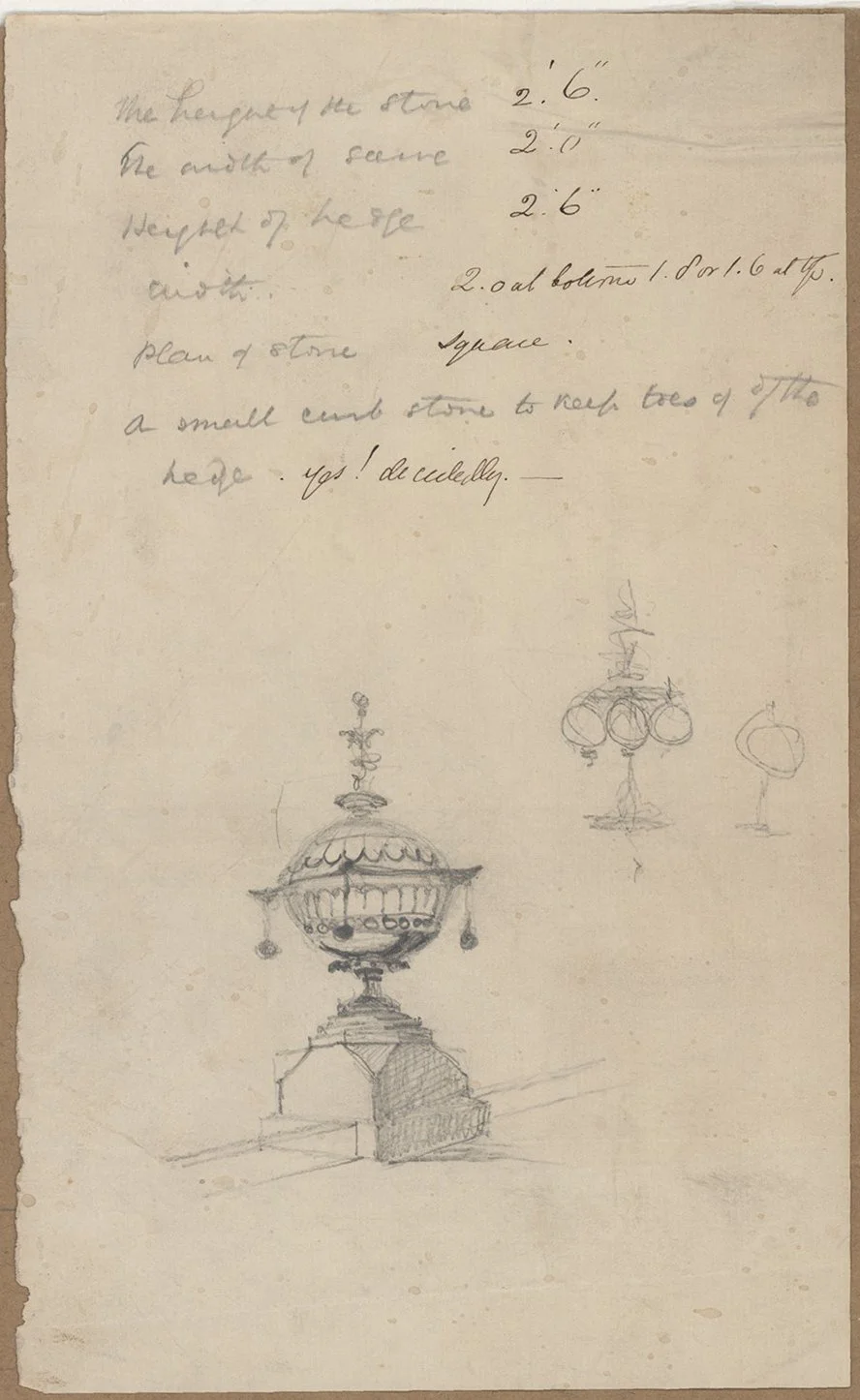
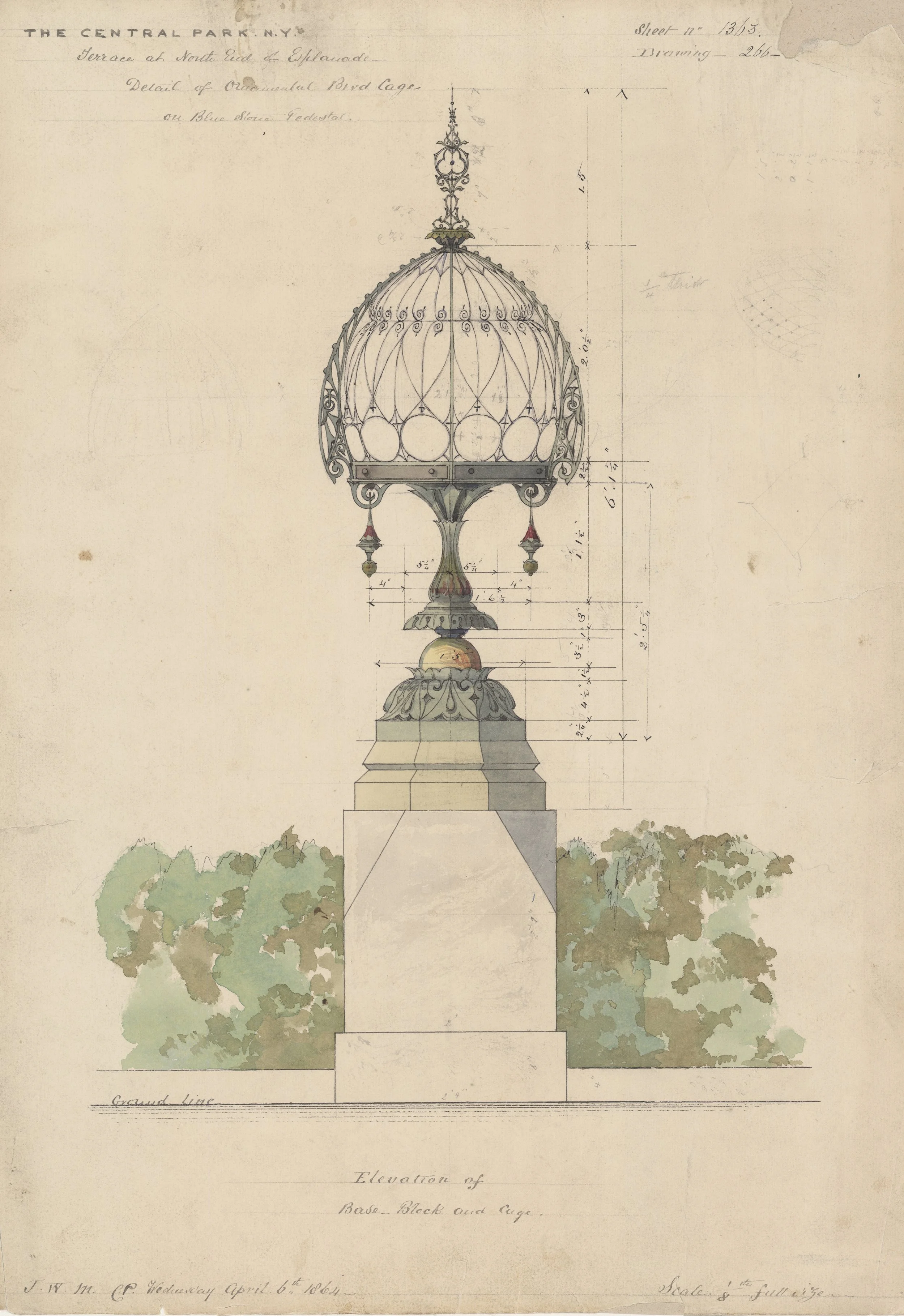
Moving away from the skating area, there is a peaceful area known as Cherry Hill, named for its spring-blooming cherry trees. The paved concourse on the crest of the hill was originally intended as a scenic turnaround for horse-drawn carriages. In the center, there is a stunning fountain. Designed for watering horses by architect Jacob Wrey Mould in 1867, it was constructed of polished granite, wrought iron and bronze, and decorative Minton tiles, with eight colorful saucers for birds to drink from.

Detail of the bird bath included on the Cherry Hill horse fountain, 1871.

Swan’s Nests 

One of the most unusual additions to the Lake were a gift of twelve swans from the city of Hamburg, Germany, in the spring of 1860. Long famous for its swan population, the city even sent a handler to help domesticate the animals. In May, the Board of Commissioners received a letter from George Kunhardt of the Hamburg Consulate with advice on the care of the new park residents, for example when to clip their wings and how to winter them over. The letter included a drawing for the construction of two types of floating nests for the comfort of the birds. One was specifically for use in quiet water while the other was suitable for nests that were exposed to the “action of waves.” The letter went on to say that their design, “may of course be varied ad libitum.” Sadly, within the first few weeks of their arrival nine of the swans died. Upon receiving the news of the birds’ demise, Hamburg replaced them with ten more, which was followed up by two dozen more sent by the city of London.

Swan’s Nests, designs with variants for rough and calm water, c. 1860. The cities of Hamburg gifted the park pairs of swans and included detailed instructions on how to build nests for them.

Gondolas 

Gondolas in Central Park, ca. 1875. Courtesy Library of Congress.

From the earliest days of the park, visitors in leisure boats enjoyed floating on the Lake. With awnings to provide shade on sunny days, the larger passenger boats carried up to twelve people. Other vessels for hire included rowboats and pleasure boats that featured large carved white swans.

Gondolas were another option for enjoying an excursion on the Lake. Former Park Commissioner John A.C. Gray donated the first gondola in 1862, sent directly from Venice. Without trained gondoliers, the gift sat unused for months until 1864. Despite some challenges in adding to the fleet, by 1870 several gondolas were afloat on the Lake with gondoliers decked out in sweaters with the word Venetzia emblazoned across their chests. 

A gondola for the Lake, c. 1864. The designer of the gondola had a sample to work from, but noted on the drawing that, “The Gondola from which these drawings were made was very imperfect.” Hence, the dimensions in the plan had to be extrapolated.

Bow Bridge 

Bow Bridge, 1868. Manual of the Corporation of the City of New York, NYC Municipal Library.

The final stop on the tour is the sweeping Bow Bridge, the longest and most famous of architect Calvert Vaux’s bridges. Named for its graceful arch reminiscent of an archer’s bow, Bow Bridge was the first of the seven cast-iron bridges in the park, and is the only one to span a body of water. 

The low-slung construction connects Cherry Hill and the Terrace on the south shore of the Lake to the Ramble on the north shore. The bridge features a 140-foot ornamental iron balustrade pierced with Gothic cinquefoils and a floral motif on the spandrels which continues in the shallow niches set into the pillars. The design includes large cast-iron urns to hold flowering plants and vines throughout the summer.

Stereograph of the Bow Bridge, n.d. Courtesy New York Public Library.

Cynthia Brenwall is the author of The Central Park: Original Designs for New York’s Greatest Treasure, Abrams Books, 2019.

America’s Forgotten 1689 Revolution and New York City’s First Mayoral Election

Leisler leaving the fort. Illustration by F. T. Merrill in Edwin Lasstter Bynner, The Begum’s Daughter (Boston: Little, Brown and Company, 1890), facing page 236. Jacob Leisler Institute.

On May 16, 1691, in a drizzling rain, two middle-aged men climbed gallows erected at present-day One Pace Plaza near the Manhattan entrance to the Brooklyn Bridge. Before the largest crowd yet gathered in the small city of 5,000 inhabitants, Jacob Leisler and his newly wed son-in-law, Jacob Milborne, were hung until half-dead then beheaded. Their alleged crimes were “levying war” against King William and Queen Mary, counterfeiting their Majesties’ great seal, murdering one Josiah Browne, and “other high misdemeanors.” The executions traumatized the onlookers. The “shrieks of the people were dreadful, some were carried away lifeless, and some rushing forwards, almost ere the life of their beloved ruler was extinct.” The political repercussions reverberated throughout New York’s colonial period and still echo today. Historians focus on Jacob Leisler as the central figure of the turmoil. Yet, the events that came to be known as “Leisler’s Rebellion” were a result of broader international and local circumstances.

The Miller Plan of 1695 shows New York City close to the time of Leisler’s Rebellion. It was made by John Miller, the chaplain of the fort from 1692-1695. Although the legal boundary of the city was approximately at Chambers Street, much of the population still lived south of the wall (Wall Street). Lithograph by George Hayward for D.T. Valentine’s Manual of 1852. Courtesy the Jacob Leisler Institute.

Charter of Liberties and Privileges. Common Council minutes October 31, 1683. REC0081, vol 1. p. 175, NYC Municipal Archives.

The Municipal Archives opens a window into these events. Following England’s final acquisition of New Netherland in 1674, New York City underwent rapid economic development. Agricultural and tobacco exports replaced the fur trade as economic drivers as city merchants also expanded into transporting enslaved Africans and finished European goods into the West Indies and the Chesapeake in exchange for rum, salt, and sugar. Population growth increased social stratification. In 1683 a representative assembly passed the Charter of Liberties and Privileges, which established self-government, declared that no taxes could be levied without the consent of a general assembly, trial by jury of one’s peers, and tolerance for all who “professe ffaith in God by Jesus Christ” (see REC0081, vol 1, pp. 175-176, 265). On April 27, 1686, Governor Thomas Dongan issued a patent that incorporated New York City, granted control of surrounding underwater lands, and formally created municipal offices including mayor, recorder, sheriff, aldermen, and assistants (inserted in REC0081, vol 2, p.7). 

A law restricting the slave trade to members of the Royal African Company. Common Council minutes August 5, 1685. REC0081, vol 1. p. 278, NYC Municipal Archives. 

A law restricting trade in the East Indies to members of the East India Company. Common Council minutes August 5, 1685. REC0081, vol 1. p. 275, NYC Municipal Archives.  

New York in 1689 remained very much a part of the European world. For a century and a half, religious wars had torn Europe apart. Theological disputes further divided congregations. In February 1685, the openly Roman Catholic James II replaced his brother Charles II on England’s throne. Particularly irksome to New Yorkers were James’s interference in New York’s economic development. In August 1685 the king banned New York City merchants from participating in the East Indies and slave trades by granting monopolies to the East India Company and Royal Africa Company (REC0081, pp. 275-282).

A Proclamation for dissolving the assembly by Governour Thomas Dongan. Common Council minutes August 13, 1685. REC0081, vol 1. p. 283, NYC Municipal Archives. 

These acts were immediately followed by James’s disallowance of New York’s Charter of Liberties (REC 0081, pp. 284-285). In October 1685, James’s cousin King Louis XIV of France revoked the Edict of Nantes granting religious toleration and instituted a violent persecution of French Protestants, known as Huguenots, in his realms. French West Indian Protestants sought sanctuary in New York, accelerating fear of a Catholic French-Canadian invasion. In 1686, James incorporated New York into the megacolony of the Dominion of New England, with Boston as capital. Now, all official business was to be conducted there. The rapid competitive rise of the new city of Philadelphia added economic stress. As the council minutes relate, on August 11, 1688, Dominion Governor Sir Edmond Andros officially annexed New York to New England (REC0081, p. 329). 

Annexation of New York to the Dominion of New England. Common Council minutes April 19, 1688. NYC Municipal Archives.

James’s actions created a fuse for an explosion. It was anticipated the king’s Protestant daughter Mary, wed to Dutch stadholder William III, prince of Orange, would be heir. On June 10, 1688, however, Queen Mary of Modena gave birth to a Roman Catholic male heir. Andros ordered August 24 as a day of thanksgiving in New York for the prince’s birth (REC0081, vol 1, pp.330-331). In England, Protestant notables, fearing a Roman Catholic dynasty, invited James’s daughter and son-in-law to seize the throne. In the wake of England’s Glorious Revolution, Boston revolted in April 1689 against James II’s government. The uprising rapidly spread across New England and into the east end of Long Island. The Suffolk County militia resolved to seize New York City’s fort. Militias of other towns joined them on their march toward the city. Alarmed by these events, New York Lieutenant Governor Francis Nicholson appointed the city’s militia captains to his expanded council (See, New-York Historical Society Collections (1868) 1: 272-290). 

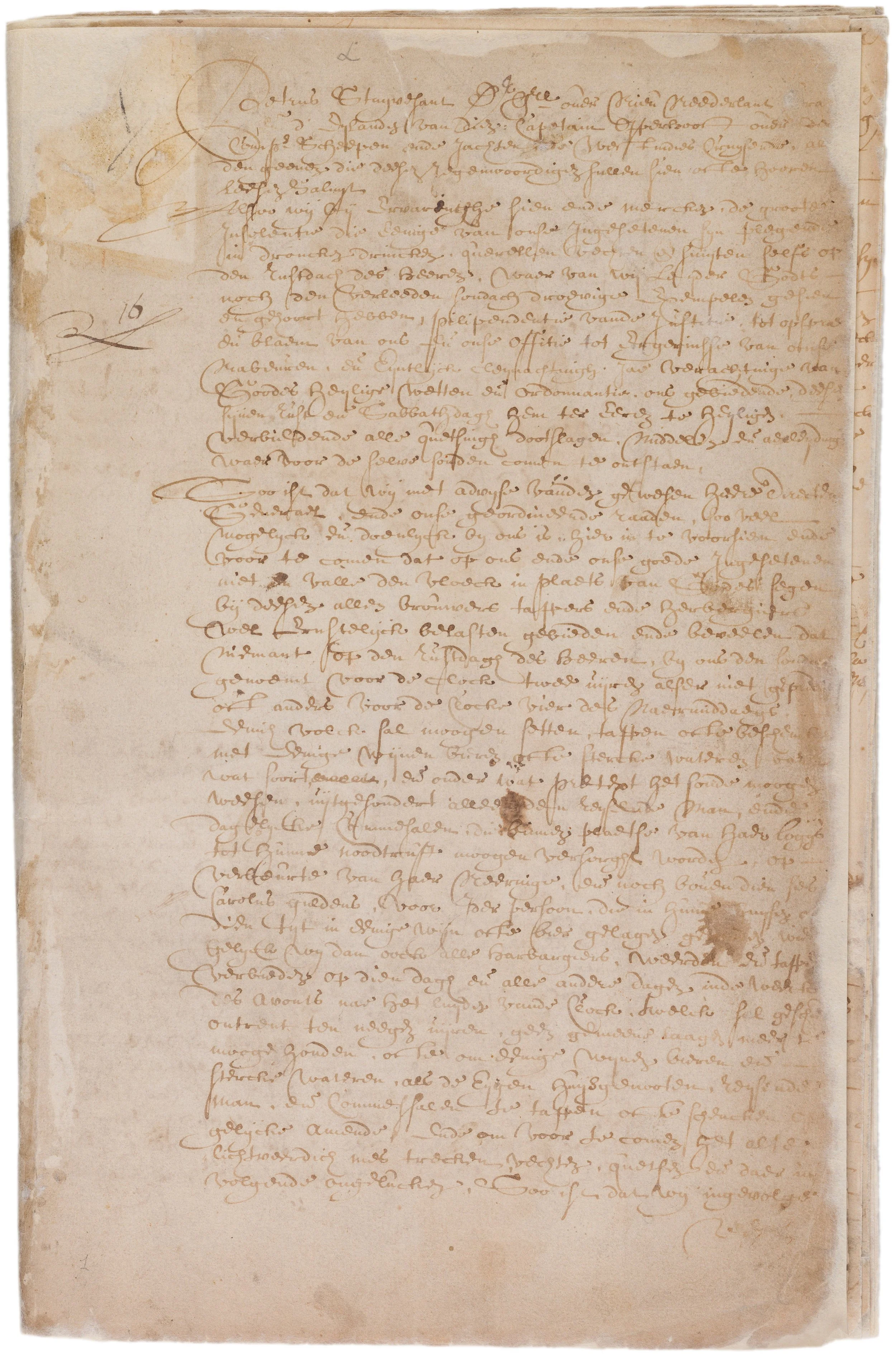
Governor Andros ordered August 24, 1688 as a day of thanksgiving for the birth of an heir to the Catholic King James II. Common Council minutes June 22, 1688. REC0081, p. 330-331, NYC Municipal Archives.

The city’s militia captains took turns guarding Fort James. But confrontations between local militiamen and English regulars resulted in the militia seizing the fort on behalf of the new king and queen, William and Mary. When militia Colonel Nicholas Bayard refused to assume control, the rebels turned to second in command, Jacob Leisler. The collapse of the Dominion of New England government with the Boston uprising and Francis Nicholson’s flight from New York on June 11 left the provincial government in a vacuum. Believing they did not have “a title to govern” without the “Peoples Resolutions,” the militia captains decided to follow Massachusetts’ precedent and call for a convention of the provincial towns. The New York militia captains sent a circular to the counties asking them to send two delegates to New York City on June 26 to consult “for the welfare of the country & the protestant religion.” The provincial Committee of Safety began deliberations on June 27. The following day, the convention reorganized the militia with Leisler as captain of the fort (PRO: CO5/1081, p. 69). 

Nicholson’s councilors Philipse, Van Cortlandt and Bayard trying to quiet the rebellion. Art by Alfred Fredericks; Engraved by Albert Bobbett for History of the City of New York: Its Origin, Rise and Progress. NYC Municipal Library. 

Leisler, a son of the Frankfurt-am-Main, Germany, French Reformed church pastor Jacob Victorian Leisler, was among New York’s wealthiest inhabitants. His ancestors had served as chaplains to the House of Nassau, family of the Prince of Orange, and were active in the European Reformed movement. Following their example, Leisler was active in New York’s Reformed communities and, after 1685, in the settlement of Huguenot refugees. Appointed captain of the fort, Leisler managed militia correspondence, strengthened defenses, and took responsibility in administering to four-hundred men a loyalty oath to the “Prince of Orange and protestant interest.” Meanwhile, the Committee of Safety took immediate steps to coordinate provincial hegemony. On August 16, the committee appointed Leisler commander in chief of the province with full civil and military powers (NHi BV Sect. L “No. 7,” 1-3).

To remove opposition, throughout late summer and fall of 1689 the Committee of Safety ordered elections by male “protestant freeholders.” Particularly irksome was that Andros’s common council continued to meet in New York City. On October 7, the Committee of Safety ordered the mayor, sheriff, clerk, and common council “be chosen By the Major vote of the freeholders.” (REC 0081, pp. 340). On October 14, Leisler, following the form of government as established by the 1686 Dongan patent, confirmed the new council with Peter Delanoy as mayor, Johannes Johnson as sheriff, and Abraham Gouverneur as clerk (REC0081, p. 344). Forty-year-old Delanoy, born in the Huguenot refugee community in Harlem, Netherlands, was a prominent figure in the city government, serving as alderman, bookkeeper of the port, and city treasurer (REC0081, p. 267 ff). In 1689 he became the first and only elected mayor of New York City prior to 1834.  

Leisler’s confirmation of the new council with Peter Delanoy as mayor, Johannes Johnson as sheriff, and Abraham Gouverneur as clerk. Common Council minutes October 14, 1689. REC0081, p. 344, NYC Municipal Archives.

Confirmed in their offices, the new city government ordered the former magistrates to deliver up all city and county books and papers in their custody. While most complied, former Mayor Stephen van Cortlandt was nowhere to be found. When Van Cortlandt’s wife, Gertrude Schuyler, received the order, the council minutes state she threw it away and retorted, “take it with force in Caise they would have it” (REC0081, p. 347). In desperation to obtain the necessary records to operate the city, the council petitioned Leisler to invest them in their offices. Meanwhile, Van Cortlandt had fled to Albany, which had formed its own convention at the outbreak of the disorders. Dominated by the relations of Leisler’s wife’s stepsisters, who had battled Leisler in an acrimonious inheritance dispute for over a decade, the former New York City officials cast themselves as a government in exile and organized a campaign to subvert his government.

In mid-December, a royal letter arrived addressed to “whomever was taking care of the government.” The Committee of Safety voted Leisler the correct recipient and disbanded. Leisler, aware of the legal situation of his lacking personal royal designation, named himself “lieutenant governor.” Believing that James II had illegally revoked the 1686 Charter of Liberties, he reestablished the provincial government according to the Charter, including an elected provincial assembly. According to a 1683 “Act of Assembly entitled An Act to Settle Courts of Justice,” Leisler instituted a four-tier system: town courts for minor issues, county courts for civil and minor criminal cases, a court of oyer and terminer for treason and major criminal cases, and the Court of Chancery to oversee matters of equity (N. 36: 14265). Records were kept in separate books, of which fragments survive.

Extant pages of Leisler’s administration reveal that the city government and its courts continued to operate in 1690. For example, loose pages of council minutes for April 26 confirmed the court resolution of a dispute between Albert Bosch and Adolf Pieterse (NNMA); those of August 9 dealt with the nuisance of a tar pit and selling of liquors (NNMA); and those of October 11, address the repairing of the Bowery Road to Fresh Water Pond (NHi: NY Misc. Mss. Box 2, No. 25). City court records during Leisler’s administration are found scattered throughout numerous archives such as in the Municipal Archives, New York Historical, Pennsylvania Historical, and the State Archives. 

“From hence begins what is acted in Governor Sloughters time March 1691.” Common Council minutes, REC0081, p. 352, NYC Municipal Archives.

Leisler’s administration created several firsts. His erection of a battery in front of the fort, known as “Leisler’s Half-Moon” or “Leisler’s Battery,” is the origin of greatly expanded Battery Park. In reaction to a French and Indian raid of the frontier community of Schenectady in February 1690, Leisler called for the first intercolonial conference independent of British authority. On May 1, 1690, representatives from New York, Massachusetts, Plymouth, and Connecticut met in New York City for the first inter-colonial congress in American history (Maryland representatives arrived late, while Pennsylvania and Virginia refused to send delegates). At this gathering, the first military action independent of European authority was organized against French Canada with a two-pronged attack by sea and land (N. 36: 42; RPAB. Ms. 4822; Ct. Colonial; M-SS. 36: 47).  

Jacob Leisler funded much of his administration out of his own pocket. But economic stress and the failure of the Canadian campaign caused him to become increasingly paranoid and erratic. The arrival of Leisler’s opponents’ lobby in England before his case was heard— his initial packets captured by the French—resulted in the crown’s appointment of a governor favorable to the opposition. Unfortunately for Leisler, the governor departed just as the crown heard Leisler’s version. The arrival in January 1691 of royal troops without official papers caused Leisler to refuse to turn over the government. His supporters flocked to his defense, resulting in armed conflict between the parties. Leisler’s subsequent refusal to immediately turn over the government upon Governor Richard Sloughter’s arrival in March 1691 due to the military practice of waiting until daylight resulted in his government’s arrest.

Governor Sloughter signing Leisler’s Death Warrant, Howard Pyle, 1901. Harper’s Magazine.

Thirty-seven members of Leisler’s government were confined and brought to trial for treason. But it was Lesler’s in-laws who most actively urged for his execution. Only Leisler and Milborne were condemned to “be severall[y] hanged by the Neck and being Alive their bodys be Cutt Downe to the Earth that their Bowells be taken out and they being Alive burnt before their faces that their heads shall be struck off and their Bodys Cutt in four parts and which shall be Deposed of as their Majties’ Shall Assigne.” It is this verdict that elicits the most attention. Governor Sloughter, however, commuted the sentence to hanging and beheading. Eight months later the crown repealed the charges and in May 1695 the king and Parliament overturned the treason sentences against Leisler and Milborne and restored their properties to their heirs.

Leisler is best understood in the context of a Calvinist political ideology emanating from the Dutch Republic and applied to English law. An ideology that emphasized decentralized government as the “ultimate way to safeguard civic liberties and economic freedoms.” Leisler thus emerged as a proponent of a unique form of populism at a time when New York was undergoing rapid change. The contest between those favoring a strong centralized government versus Leisler’s decentralized popular form subsequently evolved into a sharp political difference that has remained a characteristic in America culture ever since. 


David William Voorhees (Ph.D., New York University, 1988) is Director of both the Jacob Leisler Institute for the Study of Early New York History and of the Jacob Leisler Papers Project, and is also Managing Editor of de Halve Maen, a scholarly journal devoted to New Netherland studies published by The Holland Society of New York.


Sources: 

  • Common Council records, circa 1670-1831; REC0081; vol. 1 & 2; Municipal Archives, City of New York. 

  • Lamb, Martha J. History of the City of New York: Its Origin, Rise and Progress

  • Jacob Leisler Papers Collection, Jacob Leisler Institute, Hudson, NY. 

  • New York State Archives’ colonial records series, Albany. 

  • The New York Historical, Manuscripts.