Central Park

Drives, Rides, and Walks—Horses in Central Park

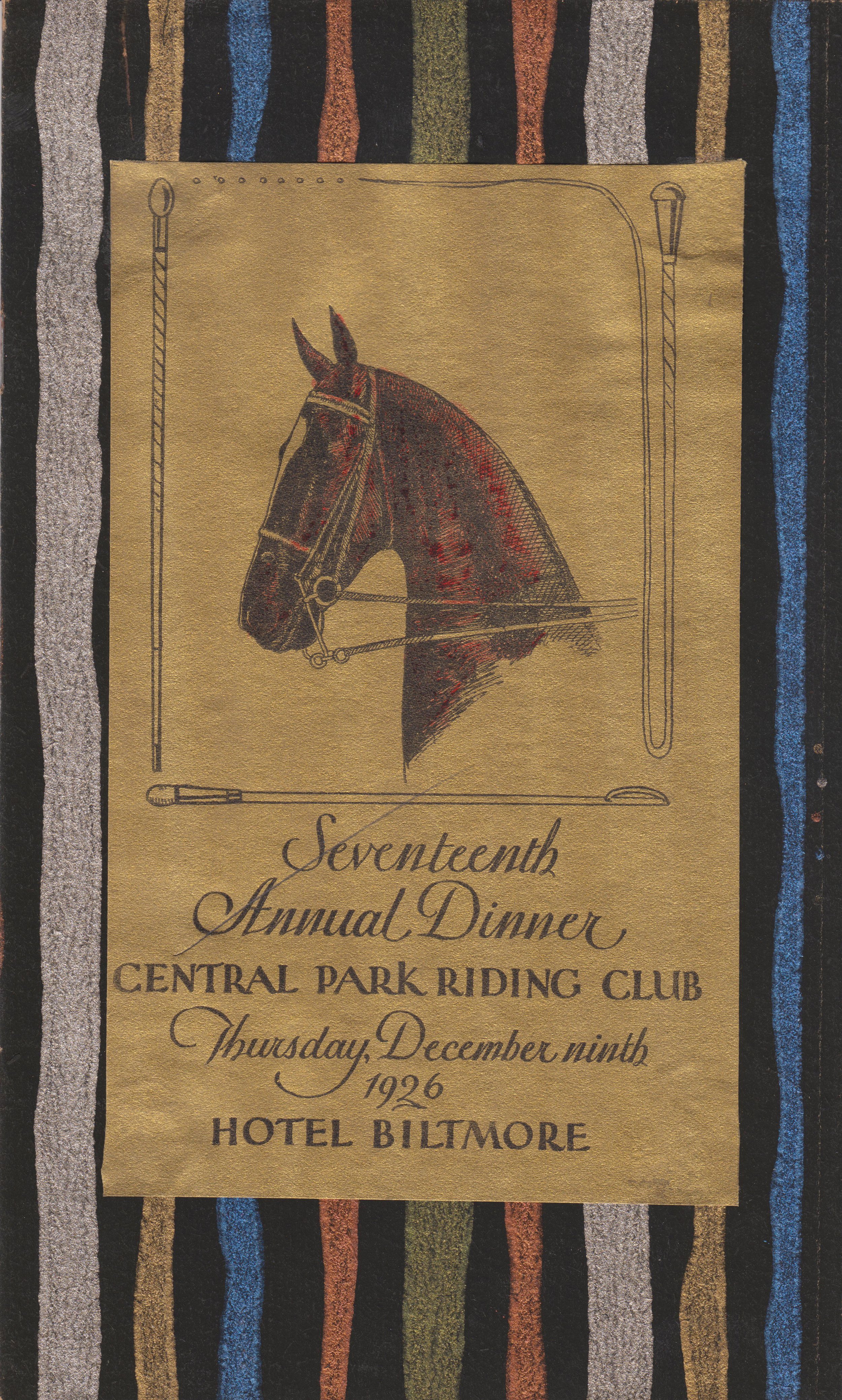
Central Park Riding Club dinner invitation, 1926. Office of the Mayor, Jimmy Walker, NYC Municipal Archives.

For more than one hundred fifty years visitors to New York’s Central Park have enjoyed picturesque vistas, rolling meadows, peaceful lakes, and a variety of charming architectural features.

Until recently, these pastoral scenes would have also included horseback riders cantering along the bridle paths. But after closure of the Claremont Riding Stables, located on Manhattan’s Upper West Side, in 2007, the horseback riders have largely vanished. Today—except for the southernmost area of the park where horse-drawn carriages still ply the roadway—horses are almost completely absent from the landscape.      

A recent For the Record blog, Horsepower: The City and the Horse introduced the topic of the horse and its profound influence on virtually all aspects of city life. This week’s article looks at how the horse informed many of the design elements of Central Park.

Central Park, shelter for carriages and horses, preliminary study, front elevation, 1871. Jacob Wrey Mould, Architect. Department of Parks Collection, NYC Municipal Archives.


Drives, Rides, and Walks

One of the most innovative features of Frederick Law Olmsted and Calvert Vaux’ design for the park was their traffic circulation system that separated walkers, horseback riders, and horse-drawn carriages, creating intimate landscapes for each type of traveler.   

The Drives were wide and sweeping, avoiding sharp turns to allow passengers in horse-drawn carriages to focus on the landscape. Park gardener Ignatz Pilat described the careful planning that went into their landscaping:       

Central Park, Bridle Road Looking South, ca. 1913. Albert W. Schaad, photographer. NYC Municipal Archives collection. Schaad was a Central Park Zookeeper who created a scrapbook of his photos.

“The effect already produced and to be perfected in the course of time, throughout the length of the ‘Ride,’ is that of a pleasant country-road shaded by over-arching trees, mingled with shrubs and vines, spaces being left for more or less expanding views of open lawns, sheets of water, and other objects of interest which give the idea of extent and diversity; but wherever these open spaces would destroy the harmony of the landscape, a few scattered trees or low shrubs are so arranged as not to obstruct the view.”

The Rides, or bridle trails, generally hugged the perimeter of the park. For pedestrians, the Walks meandered through valleys, providing glimpses of the elegant carriage traffic nearby. All routes were surfaced and drained for safe passage in all types of weather. Where arteries met, the over- and underpasses of bridges were used as much as possible to separate carriage and horse traffic from pedestrians.     

Central Park, Entrances and Gates, Entrance at 90th Street and Fifth Avenue, plan of entrance and section of adjoining wall, 1865. William H. Grant, engineer. Department of Parks Collection, NYC Municipal Archives.

Another prescient feature of Olmsted and Vaux’ design for the park, also conceived to accommodate the horse, specifically horse-drawn vehicles, were the transverse roads. The original design competition specified that each submission must include at least “four or more crossing from east to west be made between Fifty-ninth and One Hundred and Sixth Street.” Olmsted and Vaux’ ingenious scheme was to sink the roads below grade. This made it possible to keep park visitors safely above the crosstown traffic, colorfully portrayed in their proposal as “coal carts and butchers’ carts, dust carts, dung carts” and “fire companies rushing their machines with fantastic zeal at every alarm.”    


Winterdale Arch (Bridge No. 17)  

Winterdale Arch, located along the West Drive near Eighty-Second Street, is named for its location on the Winter Drive, between Seventy-Second Street and 102nd Street. When planning the west side of the park, Olmsted and Vaux intended for this section to be planted with a variety of evergreens, to add color throughout the winter for carriage- and sleigh-riders. 

Central Park, Bridge number 17 [Winterdale Arch], elevation of bridge and railing, 1861. Department of Parks Collection, NYC Municipal Archives.


Stables and Workshops 

After years of maintaining offices at Mount St. Vincent and the Arsenal, in 1869 the Central Park Board of Commissioners decided to construct “offices of Park administration” at a location that would be more easily accessible from all points in the park. The site proposed was at the northern edge of the old Yorkville Receiving Reservoir, on a sliver of land at a curve in Transverse Road No. 3, now called the Eighty-Sixth Street Transverse. The new offices would have included “engineering, architectural, and gardening apartments,” a stable with storage sheds for vehicles and machinery, and a separate building to house blacksmiths, carpenters, and other craftspeople.      

Central Park, Offices of Administration, North Wing - East End, Details of Stable Building, Keeper’s Dwelling, etc. south front and west side elevations and longitudinal sections, 1869. Attributed to Jacob Wrey Mould, Architect. Department of Parks Collection, NYC Municipal Archives.

Central Park, Offices of Administration, North Wing - East End, Details of Stable Building, Keeper’s Dwelling, etc. [detail], 1869. Jacob Wrey Mould, Architect. Department of Parks Collection, NYC Municipal Archives.

Central Park, Offices of Administration, General Ground Plan of East End of North Wing, showing stable, sheds, yard and keeper's dwelling [detail], 1869. Attributed to Jacob Wrey Mould, Architect. Department of Parks Collection, NYC Municipal Archives.


Mount St. Vincent/McGown’s Pass Tavern

In the latter part of the nineteenth century, a favorite stop for park visitors was the Mount St. Vincent Hotel. Built in 1881, it proved to be immediately popular with affluent New Yorkers, as the New York Times reported in 1886: “No matter how fast the team nor how elegant the equipage a turn ‘on the road’ is not done in proper shape unless it includes a bite or a sip in the Mount St. Vincent.  

The Hotel was located in the quiet and rustic northeastern corner of the park, a landscape filled with steep bluffs and rough terrain. The old Boston Post Road—the original mail-delivery route from New York City to Boston—meandered between two rocky ridges in this area, and in the 1750s John Dyckman built a tavern to serve travelers in the vicinity of 105th Street and Fifth Avenue. Not long after, the McGown family purchased the land and tavern, running it successfully through the Revolutionary War. Hence the name of the small valley: McGown’s Pass.      

Central Park, Mount Saint Vincent, design for a refreshment house, front elevation and side elevations, 1883. Julius F. Munckwitz, Architect. Department of Parks Collection, NYC Municipal Archives.

The McGowns held the property until 1845, when they deeded the land and buildings to the Sisters of Charity of St. Vincent de Paul, who renamed the area Mount St. Vincent’s. Within a few years, the nuns had established a convent and school. To the existing structures, they added a two-story residence for the chaplain and a stately brick convent house that contained a beautiful chapel and large dining rooms. In 1856, before the nuns had consecrated their new chapel, they received word that the city would be taking their land for the creation of the new park.

Central Park carriage ride card, n.d. Mayor James Walker collection. NYC Municipal Archives.
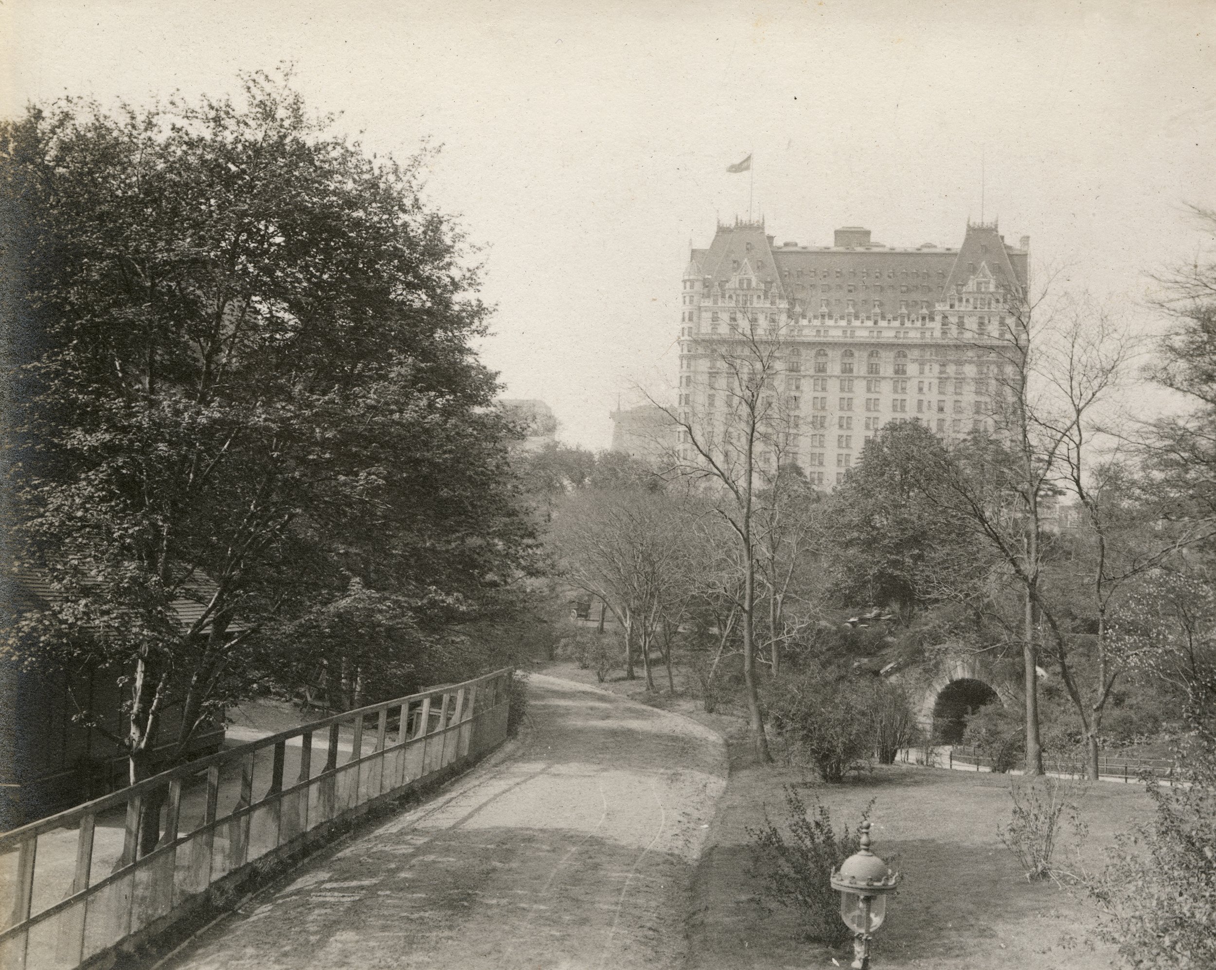
Central Park carriage ride card, n.d. Office of the Mayor, Jimmy Walker, NYC Municipal Archives.

Now owned by the city, the buildings became the park headquarters, and at one point the families of both Olmsted and Vaux lived at the site. With the outbreak of the Civil War, the US government took over the complex for use as a hospital for wounded soldiers who were, curiously enough, tended by the same Sisters of Charity who had previously owned the buildings!

Once it became known as a playground for drinking and dancing for the city’s elite, the Sisters of Charity asked that their name no longer be associated with the establishment. Renamed for the family most associated with the site, McGown’s Pass Tavern remained in operation until 1915, when its contents were put up for auction and the building torn down.   


Drinking Fountains for Horses 

Overlooking the Lake and just west of Bethesda Terrace is the peaceful area known as Cherry Hill, named for its spring-blooming cherry trees. The paved concourse on the crest of the hill was originally intended as a scenic turnaround for horse-drawn carriages, in the center of which was a stunning fountain for watering horses. Designed by Jacob Wrey Mould in 1867, it was constructed of polished granite, wrought iron and bronze, and decorative Minton tiles, with eight colorful porcelain saucers for birds to drink from.    

Central Park, Drinking fountain for horses, southwest concourse, details of bronze finial and lamp, elevation, 1871. Jacob Wrey Mould, Architect. Department of Parks Collection, NYC Municipal Archives.

Central Park, Drinking fountain for horses, southwest circle, details of bronze arm and porcelain saucer, 1871. Jacob Wrey Mould, Architect. Department of Parks Collection, NYC Municipal Archives.

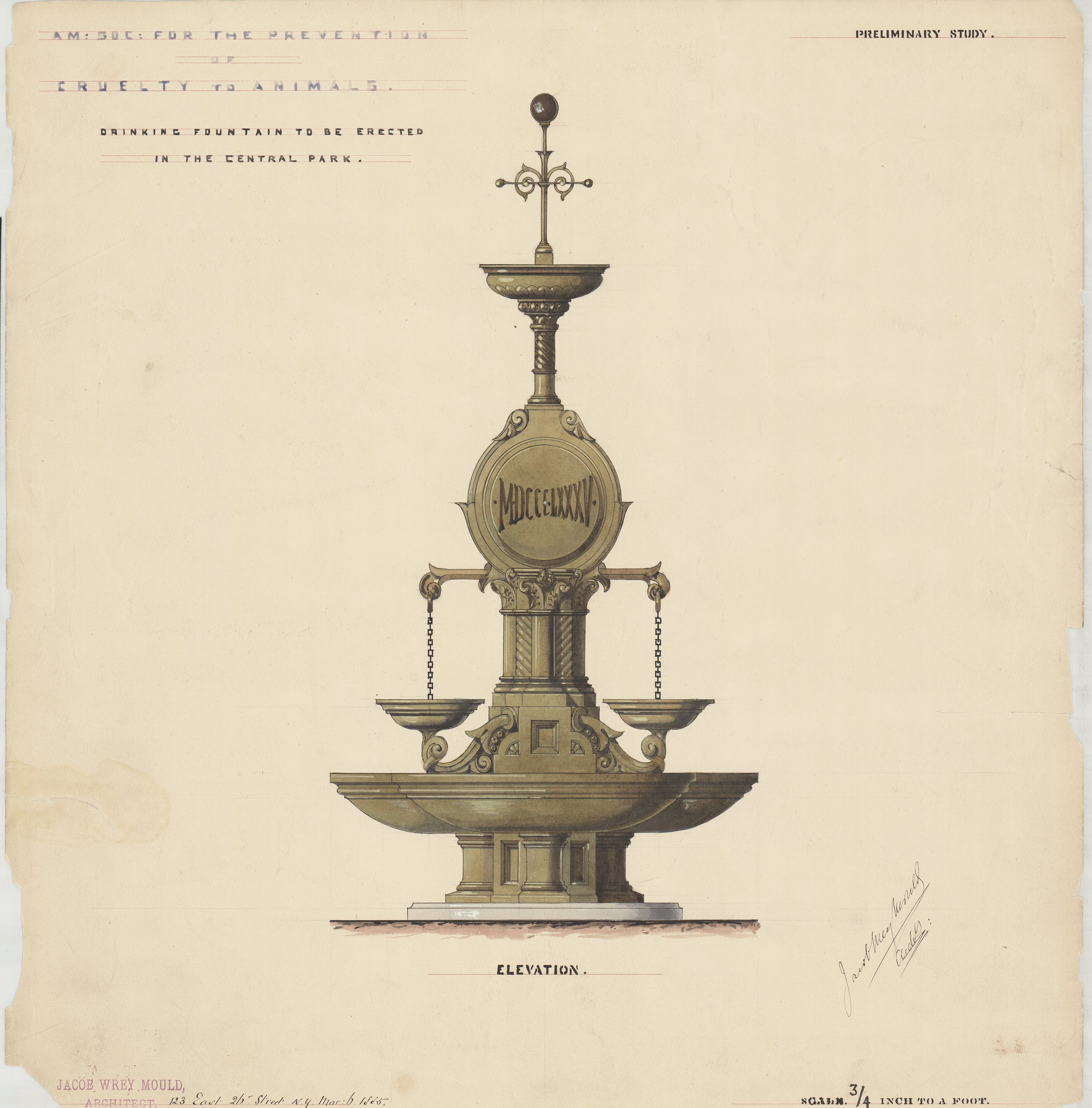
American Society for the Prevention of Cruelty to Animals: Drinking fountain to be erected in Central Park, elevation, 1885. Jacob Wrey Mould, Architect. Department of Parks Collection, NYC Municipal Archives.


The illustrations in this article, and more than 250 others, such as the original winning competition entry submitted by Olmsted and Vaux, meticulously detailed plans and elevations of many of the architectural features of the park, as well as intricate engineering drawings are included in “The Central Park: Original Designs for New York’s Greatest Treasure.” It is available at bookstores throughout the city and through on-line retailers.  

Mount St. Vincent, Central Park

New York City’s parks are open for all to enjoy year-round but the number of visitors skyrockets in the summer season. Those interested in exploring park histories are invited to research Municipal Archives’ collections for information and inspiration. Of these, the most significant is the Parks Drawings Collection which documents sixty parks, parkways, and playgrounds in Manhattan including more than 1,500 drawings of Central Park.

View at Mount St. Vincent, ca. 1863. Photo courtesy Library of Congress.

For the Record has highlighted Central Park drawings in several blogs including Skating in Central Park, The Belvedere Castle in Central Park and Central Park, a Musical Destination for all New Yorkers. This week’s article looks at the area of the park that has the richest history of use and settlement—the quiet and rustic northeastern corner. It is adapted from our book, “The Central Park: Original Designs for New York’s Greatest Treasure.”

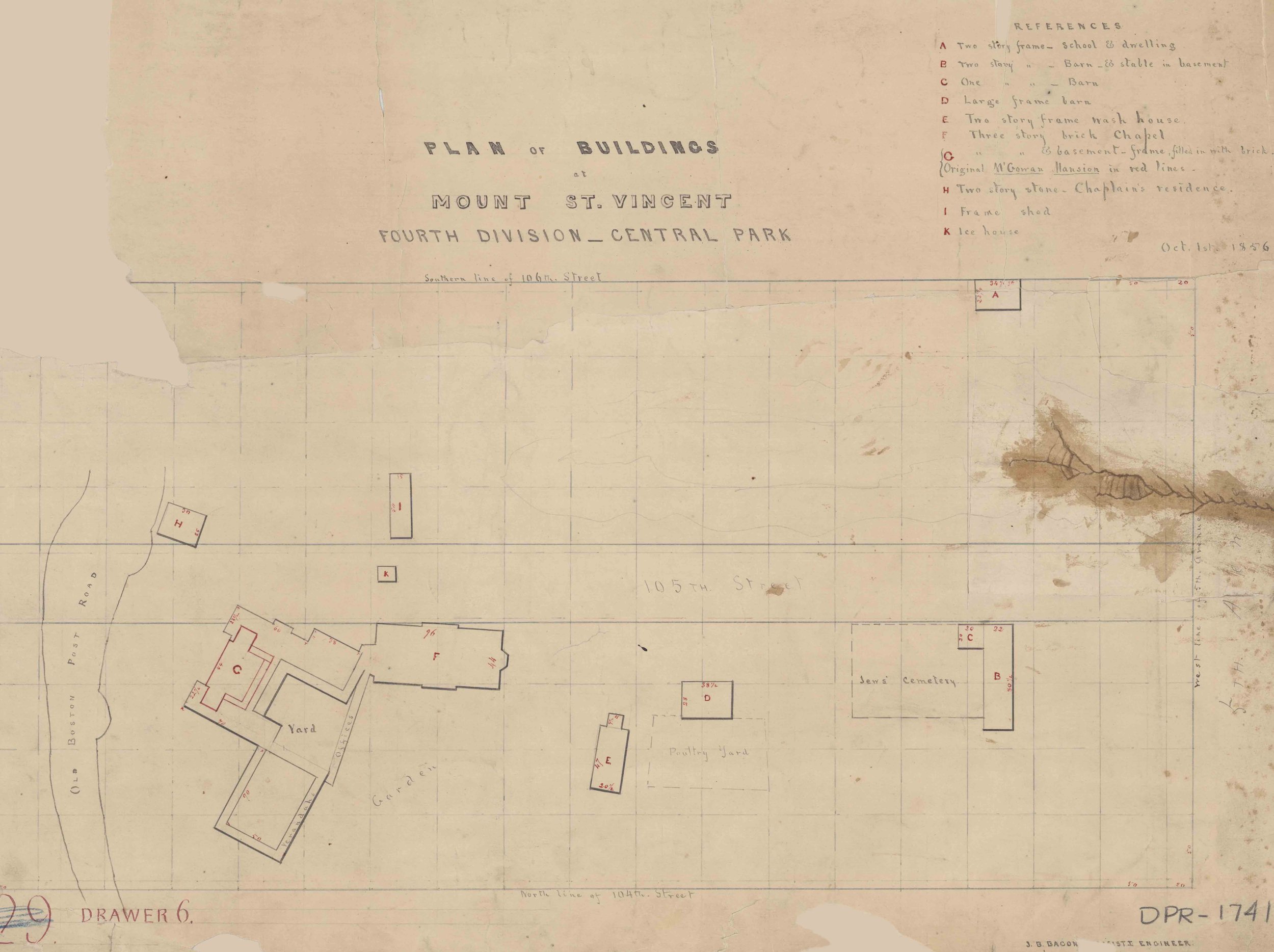
Plan of Buildings at Mount St. Vincent, 1856. Parks Drawings Collection, NYC Municipal Archives.

Established in 1673, the old Boston Post Road—the original mail-delivery route from New York City to Boston—meandered between two rocky ridges in this area just west of what is now 105th Street and Fifth Avenue. It was here, in the mid-1750s that John Dyckman built a tavern to serve travelers on the road. Not long after, Andrew McGown purchased the land and tavern, running it successfully through the Revolutionary War giving the area its name at the time: McGown’s Pass.

McGown’s Pass Tavern, Central Park, ca. 1905. Photo Courtesy New York Public Library.

The McGown family ran a prosperous business until 1845, when they deeded the land and buildings to the Sisters of Charity of St. Vincent de Paul. The nuns renamed the area Mount St. Vincent’s and within a few years, they established a convent and school. They added a two-story residence for the chaplain to the existing structures, as well as a stately brick convent house that contained a beautiful chapel and large dining rooms. The land also included a small Jewish cemetery. In 1856, before the nuns had consecrated their new chapel, they received word that the city would be acquiring their land for the creation of the new park.

Chapel and buildings at Mount St. Vincent, ca. 1865.

The nuns relocated to The Bronx, and their buildings became the early park headquarters. At one point the families of both Frederick Law Olmsted and Calvert Vaux lived in the premises while the two men had offices in the main building. With the outbreak of the Civil War, the US government took over the complex for use as a hospital for wounded soldiers who were, curiously enough, tended by the same Sisters of Charity who had previously owned the buildings.

Mount St. Vincent Art Museum, 1863. Parks Commission Annual Report, NYC Municipal Library.

After the war, the main building returned to its original use when it was leased as a restaurant, while the chapel was transformed into a museum until it burned down in 1881. Two years later, the Mount St. Vincent Hotel, based on designs by Julius Munckwitz, was built on the site. The new building proved to be immediately popular with wealthy New Yorkers, as the New York Times reported in 1886: “No matter how fast the team nor how elegant the equipage a turn ‘on the road’ is not done in proper shape unless it includes a bite or a sip in the Mount St. Vincent.”

Mount St. Vincent, Central Park, Design for a Refreshment House, 1883. Julius Munckwitz, Architect. Parks Drawings Collection, NYC Municipal Archives.

Mount St. Vincent, Central Park, Design for a Refreshment House, 1883. Julius Munckwitz, Architect. Parks Drawings Collection, NYC Municipal Archives.

Now that it was a playground for drinking and dancing for the city’s elite, the Sisters of Charity asked that their name no longer be associated with the establishment. Renamed for the family most associated with the site, McGown’s Pass Tavern remained a popular destination through the turn of the century, but as automobiles replaces horse and carriages the business took a downturn. In 1915, Parks Commissioner Cabot Ward felt that the location would be better suited for a police station. Owner Max Boehm was ordered to vacate the premises and its contents were put up for auction. While the police station was never relocated to area, in 1917 the building was torn down. In more recent history, the location of the former convent, tavern and swanky hotel is now the home of the Central Park composting operations. Throughout the year, fallen leaves and branches are brought here and turned into nutrient-rich compost, which is used for plantings and horticultural projects throughout the Park.

Take a few minutes to view some of the exquisite drawings of Central Park in the gallery.

The Greensward

On April 22, and 23, 2022, the Department of Records and Information Services will commemorate the 200th birthday of Central Park architect Frederick Law Olmsted with a pop-up exhibition featuring the original Greensward plan. Submitted by Olmsted and co-designer Calvert Vaux, the master plan won the Central Park design competition in 1858.

Rarely seen in public, the Greensward plan is considered a masterpiece of 19th-century landscape architecture. The story of its creation begins in 1852 when the city’s Board of Aldermen formed a Special Committee on Parks. The Committee proposed to build “The Central Park” in the rectangle bounded by Fifth Avenue, Eighth Avenue, Fifty-Ninth Street, and 106th Street.  

Map from Greensward Presentation board no. 2., 1858. Department of Parks and Recreation Drawings Collection, NYC Municipal Archives

The two-mile-long by half-mile-wide 778-acre plot, with its rocky outcrops of Manhattan schist rising above stagnant bogs, and home to nearly 1,600 people, was a challenging site for a park. On June 21, 1853, the State Legislature authorized the mayor to issue stock, known as the Central Park Fund, to compensate the 561 owners of the more than seven thousand lots that comprised the future park.  

Delays arising from purchasing the property and political wrangling over a plan for the park delayed further action until October 1857, when a new state-appointed Board of Commissioners announced a formal design competition. All planners were instructed to incorporate specific requirements into their presentations: at least four transverse roads, a parade ground for military drills, a two-to-three-acre formal flower garden, three playgrounds for “healthful exercise,” a site for concerts and exhibitions, a prominent fountain, an observation tower, and a winter skating area, as well as “at least one institution of cultural uplift or practical knowledge.” The budget was $1.5 million. The March 1, 1858 deadline for submissions was moved back a month when the requirements were expanded to include specifications and costs for building roads and preparing the land.  

Greensward Presentation board no. 5., (view of the Lake from Vista Rock),1858. Department of Parks and Recreation Drawings Collection, NYC Municipal Archives.
Well-connected English-born architect, Calvert Vaux, and the Connecticut-born writer, surveyor, clerk, and farmer, Frederick Law Olmsted were casual acquaintances but shared a belief that nature had the power to uplift and refine the human spirit. Vaux suggested they collaborate on a design. The new partners worked nights and weekends through the fall and winter of 1857-58. Vaux’ son, Downing, remembered that the drawings needed “a great deal of grass to be put in by the usual small dots and dashes, and it became the friendly thing for callers to help in the work by joining in and adding some grass to Central Park.”

Preparations continued to the last possible moment. Arriving at the Arsenal Building late in the evening of March 31, 1858, Olmsted and Vaux had to wake a caretaker to deliver their proposal, only minutes before the deadline for entries. Logged in under the name “Greensward” as Entry #33, it was brilliant in presentation and bold in design. Their large-scale master plan was executed on high-quality paper mounted on linen; their two texts,  the Description of a Plan for the Improvement of the Central Park “Greensward” and Particulars of Construction and Estimate, were professionally printed by William Cullen Bryant & Co.; and their twelve presentation boards featured a mix of graphite drawings, albumen prints and oil sketches related to particular views, some accompanied by a lithograph of a map to show its location.

Presentation board no. 4, detail, (view across the Lake toward Vista Rock). The “present outlines” view, attributed to the studio of photographer Matthew Brady, shows fields bordered by a stone wall, with Vista Rock rising in the background to a lookout tower. Department of Parks and Recreation Drawings Collection, NYC Municipal Archives.

Presentation board no. 4, detail, (view across the Lake toward Vista Rock). The “effect proposed” view, painted by Vaux’s brother-in-law (Hudson River School artist Jervis McEntee), shows the fields have been replaced by the Lake, rising to a landscaped hill topped by an early version of Belvedere Castle. Department of Parks and Recreation Drawings Collection, NYC Municipal Archives.

With monetary prizes being awarded to the top four entrants, the commissioners were hopeful that proposals would arrive from leading European experts in park design, but they received only two foreign entries and those were of little distinction. The entries were arranged for viewing in rented offices at 637 Broadway, along with summaries of the written components of the submissions. On April 28, 1858, the commissioners made their selections. The grand prize of $2,000 went to Vaux and Olmsted.  

Olmsted and Vaux believed in creating “scenery” that appeared to be natural, and that the park “should present an aspect of spaciousness and tranquility, with variety and intricacy of arrangement, thereby affording the most agreeable contrast to the confinement, bustle, and monotonous street-division of the city.”

They named their plan “Greensward,” a word that means ground covered with green grass. Visitors today can easily observe how the designers reserved large areas of the park for pastoral scenery with open greenswards bordered by shrubberies and groves of trees, often with nearby open water to reflect foliage and give a feeling of depth to the landscape.  

Presentation board no. 9, detail. The “effect proposed” shows Bogardus Hill (now known as the Great Hill) with a Monumental Tower. Department of Parks and Recreation Drawings Collection, NYC Municipal Archives.
The Greensward plan has long been recognized as a work of genius. The Olmsted and Vaux traffic circulation system separating walkers, horseback riders, and carriages, and the sunken transverse roads, are often considered their most innovative concepts. The plan is also notable for its inclusion of lakes and ponds. The successful installation of these features proved their mastery of landscape design on a grand scale.

The Greensward plan accepted by the board was seen through to completion, with one significant change. As the design competition played out, a consensus developed among the commissioners to extend the park to 110th Street. The additional area, filled with steep rock formations, spring-fed swampland, and thick vegetation, seemed a natural part of the park, and the cost of grading the rocky terrain to incorporate it into the city street grid would have been exorbitant. In April 1859, the board requested that the state legislature approve the purchase of the additional sixty-five acres, along with a budget to provide for construction. It took until 1863 to settle the eminent domain disputes over the property valuations.

Presentation board no. 2, detail, (view toward ball field and Umpire Rock). The “effect proposed” shows a pavilion for visiting spectators (never built) sits on Umpire Rock, while ballplayers take the field in the foreground. Department of Parks and Recreation Drawings Collection, NYC Municipal Archives.
The Department of Parks displayed the Greensward plan in the Arsenal, their headquarters in Central Park, for many years. In 2015, the original plan was transferred to the Municipal Archives and a high-quality replica took its place in the Arsenal.   

Read the full story of the Olmsted and Vaux collaboration and creation of the Greensward plan in The Central Park, Original Drawings for New York’s Greatest Treasure, by Cynthia Brenwall, and plan a visit to the Municipal Archives on April 22 or 23 to examine this extraordinary artifact.

Open for public viewing, free timed tickets are required to ensure safety. Tickets are available for 30-minute visits on the following dates: April 22, 2022 - 11 a.m. to 7 p.m. and April 23, 2022 - 10 a.m. to 4 p.m.

Use this link to sign up for your free tickets:

https://www.eventbrite.com/e/celebrate-olmsted-bicentennial-the-greensward-plan-for-the-central-park-tickets-288125680667?aff=ebdsoporgprofile

The Belvedere Castle in Central Park

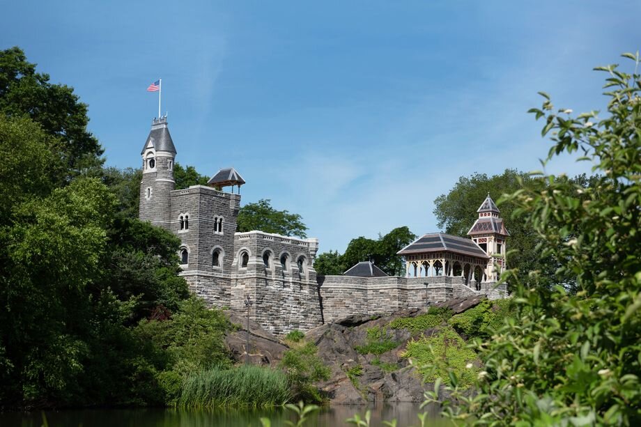
Belvedere Castle, ca. 2019. During a 15-month restoration by the Central Park Conservancy new glass windows and doors were added, the structures and terraces were repaired, a new drainage system was put into place, and a newly recreated wood tower was added at the castle’s northwest corner. Photograph courtesy Central Park Conservancy.

Belvedere Castle, ca. 2019. During a 15-month restoration by the Central Park Conservancy new glass windows and doors were added, the structures and terraces were repaired, a new drainage system was put into place, and a newly recreated wood tower was added at the castle’s northwest corner. Photograph courtesy Central Park Conservancy.

The collection of Parks Drawings at the Municipal Archives are often called the “jewel in the crown” within the holdings. It includes hundreds of exquisite plans and designs of parks throughout the city and in particular, Central Park. Originally created to illustrate the park designers’ intentions and to guide those who built the parks, many of these drawings are now considered works of art. Some are again being utilized as “working” drawings, providing essential information for on-going restoration projects in the parks. One of the most visible of the recent projects is the Belvedere Castle. 

Study for the Belvedere Castle, 1870.  Department of Parks Drawings Collection. NYC Municipal Archives.

Perched atop the high-rising Vista Rock in Central Park, Belvedere Castle has an interesting history. As early as 1859, park designers Calvert Vaux and Frederick Law Olmsted had planned on placing an object of visual interest at “the highest and most remote part of the hill as seen from the terrace.” The men recognized that the location of the rocky outcrop, the second-highest point in the park after Summit Rock, would provide visitors with an overlook that showed off the scenic splendors of the north and south ends of the expanse including the Ramble and the original Croton Reservoir (now the Great Lawn).

Park visitors enjoying Belvedere Castle c. 1885. DeGregario Lantern Slide Collection, NYC Municipal Archives.

Designed in 1865 by Vaux and fellow architect Jacob Wrey Mould as a Victorian folly or “eye-catcher,” the miniature castle would not have been out of place in any European pleasure ground. Built at a three-quarter scale in a Norman-Romanesque style, it worked to create a nostalgia for another place and time, a popular theme in the grand European parks of the day. Belvedere was constructed out of the same gray Manhattan schist that formed Vista Rock. From the Terrace, Belvedere (Italian for “beautiful view”), is a picturesque, arresting  nd distant visual focal point.  It draws the viewer’s gaze up through the nearby Ramble, which was planted with dark foliage that made bold reflections on the surface of the Lake.

Shelter 1, Belvedere Castle, 1871.  The small shelter was Jacob Wrey Mould’s replacement for the planned second stone tower. Department of Parks Drawings Collection, NYC Municipal Archives. 
Section and elevations, Belvedere Castle, 1867. Department of Parks Drawings Collection, NYC Municipal Archives.

The Parks Drawings include several original designs of the Belvedere Castle. The earliest plan, dating from 1867, shows two towers on the grounds. The buildings were open structures with no doors or windows, to be used as a venue “for gathering and shelter of a number of visitors in an informal picturesque way at this attractive point.” The foundations for both were dug in that year, but by 1870 only the main building, with its distinctive flag and clock tower, was underway. The Architect-in-Chief, Jacob Wrey Mould  (Vaux and Olmsted resigned from the park in 1870 after the new Tweed regime led by Peter Sweeny took over) was determined to finance his recently designed sheepfold buildings rather than the Belvedere.The Board of Commissioners of the newly-formed Department of Public Parks agreed to replace the projected second stone building with a small wooden pavilion of Mould’s design. This saved an estimated $50,000 and was found to be “. . .  quite satisfactory to the public.” 

Belvedere Castle, ca. 1980. Photograph courtesy Central Park Conservancy.

Belvedere Castle, ca. 2019. Photograph courtesy Central Park Conservancy.

As with many of the buildings in the park, the purpose of the castle changed over time. In 1919, the U.S. Weather Bureau converted the building into a weather station, adding windows and doors to create offices within the structure. When they relocated in the 1960s, the Castle fell into disrepair and became a target of vandalism. In 1983, the Central Park Conservancy undertook the first of their two renovations of the building and reopened it as a visitor center. In 2019, they completed an extraordinary project to restore and modernize the building and terraces which included, among other things, the reconstruction of the wooden pavilion and improved access to the site.

Central Park: A Musical Destination for all New Yorkers

The blog this week highlights the long tradition of music concerts in Central Park. It is adapted from our new book, “The Central Park: Original Designs for New York’s Greatest Treasure.”

Alterations to Music Pavilion, mason’s and carpenter’s contract, 1886. Black and colored inks with colored washes on paper backed with linen, 23¾ x 34¾". Department of Parks Collection, NYC Municipal Archives.

The vividly colored Music Pavilion was originally constructed in 1862 and was moved to several different locations on the Mall during its lifetime. Jacob Wrey Mould prepared this drawing for alterations to the structure in 1886.

New Yorkers have enjoyed musical performances in Central Park from its earliest days. Park planners Calvert Vaux and Frederick Law Olmsted believed that their urban oasis should provide not only “healthful recreation,” but also serve as a cultural destination for the appreciation of art and beauty. In 1859, an estimated five thousand people delighted in the first formal concert at a temporary bandstand built in the newly-opened Ramble.

Temporary winter covering for the Music Pavilion, carpenter’s and ironmonger’s contract, 1869. Black ink with colored washes on paper backed with linen, 19½ x 21". Department of Parks Collection, NYC Municipal Archives.

As crowds grew larger, Vaux and Olmsted decided that the west side of the Mall, near the Bethesda Terrace, would be the ideal spot for a permanent structure. As they explained to the Board of Commissioners of the Central Park: “This site is recommended because it is conspicuous without being obtrusive, and is easy to access from the promenade [later known as the Mall] and from one of the leading avenue entrances; while, to the north, it commands from its terraces and verandas the finest views that are to be obtained in the lower part of the park.”

By 1862, the overwhelming popularity of free concerts in the park prompted the Board of Commissioners to approve building a permanent Music Pavilion to be located at the north end of the mall. Architect Jacob Wrey Mould’s Moorish-influenced cast-iron and wood bandstand, with six slender red columns that carried a bright blue cupola decorated with gilt stars, is still considered one of his park masterpieces.

Study for a floating music pavilion on the Lake, c. 1861. Black ink and pencil with colored washes on paper backed with linen, 17½ x 18½". Department of Parks Collection, NYC Municipal Archives.

These detail maps show the pavilion’s positions on the Lake during a concert and when not in use; the central panel lifts up to reveal a second seating arrangement for a larger orchestra.

Before the Music Pavilion was built, Olmsted had toyed with a much different location. In 1861, he wrote to Central Park Board Commissioner Andrew Haswell Green suggesting that a bandstand floating on the Lake might be the best place to feature orchestras and bands during the concert season. Always fearful that large crowds of any size would trample and ruin the grass, Olmsted also believed that acoustics on the Lake would carry the music to listeners scattered around its shores, including on the Terrace, where chairs could be placed. The structure could be movable and would offer seating arrangements for both large and small groups of musicians. In the end, it was Mould’s Music Pavilion that was built, but occasionally a ten-man cornet band would give afternoon concerts from a boat on the water.

Here the Music Pavilion can be seen in its original location at the north end of the mall just behind a small decorative fountain that lead toward to the Terrace. The Pavilion would later be moved further the south and the fountain would be removed altogether. Department of Parks Collection, NYC Municipal Archives.

Large crowds gather to enjoy a concert in the park, c. 1910. The bench seating was designed by Calvert Vaux especially for concert-goers around the Music Pavilion. Photo by A. Tennyson Beals, NYC Municipal Archives Collection.

Design for modification of the area in the vicinity of the Music Stand on the Mall, c. 1865. Black and colored inks with colored washes on paper backed with linen, 28 ½ x 21 1/4." Department of Parks Collection, NYC Municipal Archives.

In this drawing prepared by Calvert Vaux, we can see the Music Pavilion located along the western side of the mall. In 1884, a statue of Ludwig Van Beethoven was installed near this location of the Pavilion where it still stands today.

In 1921, Elkan Naumburg, a retired banker and music lover, offered the city $100,000 to replace the acoustically outdated Mould Pavilion. Naumburg’s nephew William Tachau designed the new venue in a neoclassical style. It was constructed with cream-colored Indiana limestone with side staircases and a coffered and gilded half-domed ceiling. Dedicated in 1923 and described as a “Temple of Music,” the Naumburg Bandshell is one of the few examples of the City Beautiful architectural style in the park. It is nestled into a hillside near the Mall and Pergola and has hosted everything from orchestral performances and big band era dances to a rousing speech by Martin Luther King Jr.

In addition to the Music Pavilion and the Bandstand, in more recent years the Great Lawn and the Sheep Meadow have served as open-air venues for concerts on a much grander scale. Ranging from Barbra Streisand in 1967 and Elton John in 1980 to the massive crowds that flood through the gates to see the annual concert given by the New York Philharmonic each year, the park has been filled with music to the delight of all New Yorkers for over 160 years.

Harvest dance contest at Naumburg Bandshell, September 1942. NYC Municipal Archives Collection.

Music remained a popular attraction in the park even after the removal of Mould’s Music Pavilion. The Naumburg Bandshell, designed by William Tachau, replaced it in 1923 and is still in use today.

These illustrations, and more than 250 others, such as the original winning competition entry submitted by Olmsted and Vaux, meticulously detailed plans and elevations of many of the architectural features of the park, as well as intricate engineering drawings are included in “The Central Park: Original Designs for New York’s Greatest Treasure.” It is available at bookstores throughout the city and through on-line retailers.

Mayor Edward Koch walking through the crowds while waiting for the start of the annual concert given by the New York Philharmonic in Central Park, August 8, 1983. Mayor Edward I. Koch Collection, NYC Municipal Archives.

The Philharmonic’s concert in 1986 had an estimated attendance of 800,000 people, one of the largest gatherings for a musical event in the history of the park.

The Central Park: Original Designs for New York’s Greatest Treasure, a conversation with author Cynthia Brenwall

The Department of Records & Information Services is pleased to announce The Central Park: Original Designs for New York’s Greatest Treasure, will be in bookstores beginning Tuesday, April 16. We asked author Cynthia Brenwall, conservator at the Municipal Archives, to share her favorite stories about the park and to highlight some of the beautiful drawings from the collection that are featured in the book.

Kenneth Cobb: One of the most striking drawings in the collection, the gilded bird cage, is on the cover of the book. Is it true that the cages contained live birds in the early years of the park?

Ornamental birdcage on a blue stone pedestal, 1864.

Attributed to Jacob Wrey Mould, architect.

Black ink and watercolor with pencil on paper, 18 ½ x 13 ¼ inches

Cynthia Brenwall: Yes, they put live birds in the cages for the enjoyment of visitors promenading on the mall near the Terrace. We do not know when they removed the cages, but their bases are still in the park today, used to hold large floral planters.

KC: It must have been difficult to choose from the more than 1,500 drawings of the park in the collection. Can you describe how you came up with the overall organization of the book?

CB: With so many amazing drawings in our collection, my hardest task was selecting items that best represented different areas of the park. The creators of the park, Olmsted and Vaux, felt that the view and the scenic landscape that they devised were the most important aspect of the park. I wanted to find a way to convey how they made sure a visitor would experience a “respite for the eye and the soul,” as I put it, from any point in the park. In the southern end of the park they installed a formal landscape with linear views and features such as distinctive bridges, natural looking bodies of water and pathways for pedestrians, horses and carriages. Moving northward in the park, the view becomes more rugged featuring the natural landscape of rock outcroppings, rolling hills and long vistas. Finally, there is the ceremonial and architecturally detailed Bethesda Terrace and Mall—the heart of the park.

Map of Central Park, c. 1875. Black ink on linen, 24 x 74 inches.

This map shows work both planned and completed as of the mid-1870s. It includes Drives, Rides, Walks, bridges, named gates, and major structures as well as several building that were being planned at the time but were never completed.

In the early stages of shaping how I would display the drawings in the book, I found a very detailed map of the park from 1872. As I began identifying all the places on the map that corresponded to the drawings I realized I could organize the book as though the visitor were strolling through the park, enjoying these ever-changing, but always pastoral, views.

Huddlestone Arch, plan showing the southern elevation and a schematic sketch of the north side, 1864.

Black ink with pencil on graph paper, 13 ¼ x 16 ½ inches

KC: We often say that along with the Brooklyn Bridge, Central Park was one of the greatest public works achievements of the 19th century. What were some innovative features of the park that you found illustrated in the drawings?

CB: Probably the best known feature is the transverse roads. Again, it was all about the views. The designers knew they had to accommodate vehicular traffic across the park but did not want to spoil the views, or the visitors’ sense of being in a natural landscape. The below-grade transverse roads brilliantly solved the problem. This design feature contributed to Vaux and Olmsted’s submission, “The Greensward” being selected as the winning entry in the contest to design the Park

Another of my favorite innovative designs is the Huddlestone Arch in the northern section of the park. It is constructed completely out of stones excavated during park construction. It uses only gravity (no mortar or other binding materials) to hold it together and it is still today a load-bearing (cars and trucks instead of horse drawn carriages) roadway carrying the East Drive over the Loch. The largest stone is estimated to weigh two tons.

Plan of Terrace drainage, showing drains and basin, 1863. Black and red ink colored washes and pencil on graph paper, 16 x 13 inches

Some of the most fascinating drawings are those pertaining to the unseen, but very necessary drainage system devised for the swampy areas of what became the park. George E. Waring, Jr., age 23, was the original drainage engineer. He developed a spider web of clay drains that carried water in and out of the park lands, and the collection contains stunning drawings of the wells and how the system worked.

Another new technology illustrated by the drawings were tree grates—probably not something that park visitors give much thought to. They were first developed in Paris as a way to allow trees to root deeper in the earth along walkways, and to prevent people from trampling on new plantings. The first use of tree grates in America was our Central Park.

Ornamental tree gratings, ironmonger’s details, c. 1872. Ink and watercolor on paper, 18 x 20 inches

KC: What are some of the other hidden secrets of the park that you discovered during your research for the book?

Drinking fountain on the Esplanade, elevation, stonecutter’s and ironmonger’s contract, 1865. Jacob Wrey Mould, architect.

Black and colored inks with colored washes on paper, 14 x 10 inches

CB: Drinking fountains! The park planners knew how important water would be for park visitors, both human and animal. And speaking of water for animals, the design for the drinking trough for horses is a lovely example of their attention to the smallest detail. We have two drawing that show drinking fountains for horses, one of which is still in the park today at Cherry Hill near the Lake. It features Minton Tiles and bird baths above the drinking trough.

The drinking fountains for people are placed throughout the park. Several near the Terrace included a hidden luxury—water would pass over blocks of ice providing chilled water on hot summer days. During the early years of the park, the drinking fountains featured a shared common cup attached with a chain to the fountain. Fears of communicable diseases, such as cholera and yellow fever, led to the end of the common cup practice after 1910.

KC: I expect that many readers will enjoy the drawings of the Paleozoic Museum and the rendering of what they thought a dinosaur would look like.

CB: There was to be a Paleozoic Museum on the west side of the park. They built the foundation for the museum, and plaster models of the dinosaurs, but the City’s political leaders at that time, ca. 1871, preferred lighthearted entertainment rather than educational or cultural institutions within the park.

Paleozoic Museum, transverse view with specimens, 1870. Ink and watercolor on paper, 19 x 26 inches.

This side view shows an example of an interior scene proposed for the museum, which was to include aquariums, geological specimens as well as reconstruction of dinosaurs in the main exhibition hall.

KC: Have you thought of a name for your dinosaur?

CB: No, not yet. Maybe we should make that into a contest… name the dinosaur??!!

KC: Are all the features of the park that we enjoy today included in the original design?

Swedish Schoolhouse (Svenska Skolhauset), perspective view and ground plan. Magnus Isaeus, architect, 1876. Black ink and pencil on paper, 21 x 14 inches.

The Swedish Schoolhouse is the only structure in park that was originally designed for something other than Central Park

CB: The Swedish Schoolhouse (now the marionette theater and called the Swedish Cottage) is the only building that was not designed specifically for the park. It had been built as the Swedish entry into the Philadelphia World Exhibition of 1876 and was later transplanted to Central Park. Over the years it has served as a bike shelter, an entomological laboratory, a library and even a Civil Defense headquarters during WWII.

And of course legendary Park Commissioner Robert Moses made numerous changes to the park. The original park plan did not include playgrounds as we know them, but rather large open areas for “healthful recreation.” Moses installed nearly forty “pocket playgrounds” throughout the park in the 1930s and early 40s.

KC: I know that you conducted a great deal of research to provide context for the illustrations in the book. What were some of the most useful resources?

CB: I made extensive use of Parks Commission and Department annual reports here in our Municipal Library, as well as the minutes and reports of the City’s legislative bodies—the Common Council, Board of Aldermen, etc. in the Municipal Archives. These government records helped me follow how changes in the city’s political landscape translated into changes in our park landscape. They also provided good factual data about payments, work timelines and specific projects that were completed during a given time period.

KC: What is your favorite place in the Park?

Drinking fountain for horses, bronze details, 1871. Black and red ink with colored washes on paper, 17 x 25 inches

CB: I love the more wild and untamed landscapes of the north end of the park. There are many hidden features to discover near the Loch and it feels like you are wandering through the country-side.

KC: Favorite drawing?

CB: There are so many amazing drawings in our collection. I love the tilework designs within the Bethesda Terrace Arcade. I spent a lot of time on the conservation treatment of that drawing and the tiles are stunning. But my absolute favorite drawing is the simple temporary enclosure post that I used at the end of the book. It is minimal and elegant and represented to me that no detail was too small to be overlooked in the design of the park. That, and the fact that it is one of the few drawings to include the names of the architects Calvert Vaux and Jacob Wrey Mould as well as Frederick Law Olmsted who was serving as the president and treasurer of the Board of Commissioners.

Temporary enclosure posts for Central Park, 1872.

Ink and watercolor on paper, 19 x 12 inches

This preliminary study was prepared by Vaux and Mould and was approved by Olmsted, who was serving as the president and treasurer of the Board of Commissioners at the time.